Blust Dam Reservoir Report
Nearby: Whitney Dam 1 Rock Bass Allot 2 Dam
Last Updated: February 4, 2026
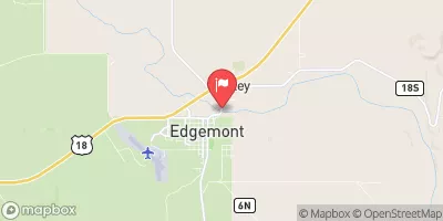
Blust Dam, located in Dawes County, Nebraska, serves as a crucial infrastructure for flood risk reduction along the TR-Big Cottonwood Creek.
°F
°F
mph
Wind
%
Humidity
15-Day Weather Outlook
Summary
Built in 1950, this privately-owned Earth dam stands at a height of 18.6 feet and has a storage capacity of 111.5 acre-feet. The dam plays a vital role in protecting the surrounding area from potential flooding events, with a hazard potential rated as low.
Despite its importance in flood control, Blust Dam has not been rated for its condition assessment as of the last inspection in 2016. However, it is regularly inspected every five years to ensure its structural integrity and functionality. The dam's primary purpose is to mitigate flood risks, and it is regulated and permitted by the Nebraska Department of Natural Resources, showcasing the commitment to maintaining water resource management standards in the region. With its location in a scenic area surrounded by nature, Blust Dam stands as a testament to the collaboration between private ownership and state regulatory agencies in safeguarding the local community from potential water-related disasters.
Year Completed |
1950 |
Dam Length |
320 |
Dam Height |
18.6 |
River Or Stream |
TR-BIG COTTONWOOD CREEK |
Primary Dam Type |
Earth |
Surface Area |
14 |
Hydraulic Height |
18.6 |
Drainage Area |
0.69 |
Nid Storage |
111.5 |
Structural Height |
18.6 |
Hazard Potential |
Low |
Foundations |
Soil |
Nid Height |
19 |
Seasonal Comparison
Hourly Weather Forecast
Nearby Streamflow Levels
Dam Data Reference
Condition Assessment
SatisfactoryNo existing or potential dam safety deficiencies are recognized. Acceptable performance is expected under all loading conditions (static, hydrologic, seismic) in accordance with the minimum applicable state or federal regulatory criteria or tolerable risk guidelines.
Fair
No existing dam safety deficiencies are recognized for normal operating conditions. Rare or extreme hydrologic and/or seismic events may result in a dam safety deficiency. Risk may be in the range to take further action. Note: Rare or extreme event is defined by the regulatory agency based on their minimum
Poor A dam safety deficiency is recognized for normal operating conditions which may realistically occur. Remedial action is necessary. POOR may also be used when uncertainties exist as to critical analysis parameters which identify a potential dam safety deficiency. Investigations and studies are necessary.
Unsatisfactory
A dam safety deficiency is recognized that requires immediate or emergency remedial action for problem resolution.
Not Rated
The dam has not been inspected, is not under state or federal jurisdiction, or has been inspected but, for whatever reason, has not been rated.
Not Available
Dams for which the condition assessment is restricted to approved government users.
Hazard Potential Classification
HighDams assigned the high hazard potential classification are those where failure or mis-operation will probably cause loss of human life.
Significant
Dams assigned the significant hazard potential classification are those dams where failure or mis-operation results in no probable loss of human life but can cause economic loss, environment damage, disruption of lifeline facilities, or impact other concerns. Significant hazard potential classification dams are often located in predominantly rural or agricultural areas but could be in areas with population and significant infrastructure.
Low
Dams assigned the low hazard potential classification are those where failure or mis-operation results in no probable loss of human life and low economic and/or environmental losses. Losses are principally limited to the owner's property.
Undetermined
Dams for which a downstream hazard potential has not been designated or is not provided.
Not Available
Dams for which the downstream hazard potential is restricted to approved government users.


 Blust Dam