Larson Dam 1289 Reservoir Report
Nearby: Marshalek Road Dam Sartore Dam
Last Updated: February 22, 2026
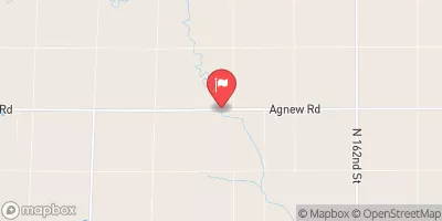
Larson Dam 1289 is a local government-owned structure located in Lancaster, Nebraska, along the TR-Little Rock Creek.
Summary
Built in 1972, this earth dam stands at a height of 25.1 feet and has a storage capacity of 33.2 acre-feet. While its primary purpose is flood risk reduction, it also serves other functions within the region.
Despite being categorized as having a low hazard potential, Larson Dam 1289 has been assessed as being in poor condition as of June 2017. The dam is regulated by the Nebraska Department of Natural Resources, with state permitting, inspection, and enforcement processes in place. With a drainage area of 1.42 square miles and a maximum discharge rate of 229 cubic feet per second, the dam plays a crucial role in managing water resources in the area.
Although Larson Dam 1289 may not be the largest or most high-profile structure, its significance lies in its contribution to local water resource management and flood risk reduction efforts. As climate change continues to impact the frequency and intensity of extreme weather events, dams like Larson Dam 1289 will play an increasingly important role in protecting communities and ecosystems from the threats of flooding and water scarcity.
°F
°F
mph
Wind
%
Humidity
15-Day Weather Outlook
Year Completed |
1972 |
Dam Length |
415 |
Dam Height |
25.1 |
River Or Stream |
TR-LITTLE ROCK CREEK |
Primary Dam Type |
Earth |
Surface Area |
0.1 |
Hydraulic Height |
25.1 |
Drainage Area |
1.42 |
Nid Storage |
33.2 |
Structural Height |
25.1 |
Hazard Potential |
Low |
Foundations |
Soil |
Nid Height |
25 |
Seasonal Comparison
5-Day Hourly Forecast Detail
Nearby Streamflow Levels
Dam Data Reference
Condition Assessment
SatisfactoryNo existing or potential dam safety deficiencies are recognized. Acceptable performance is expected under all loading conditions (static, hydrologic, seismic) in accordance with the minimum applicable state or federal regulatory criteria or tolerable risk guidelines.
Fair
No existing dam safety deficiencies are recognized for normal operating conditions. Rare or extreme hydrologic and/or seismic events may result in a dam safety deficiency. Risk may be in the range to take further action. Note: Rare or extreme event is defined by the regulatory agency based on their minimum
Poor A dam safety deficiency is recognized for normal operating conditions which may realistically occur. Remedial action is necessary. POOR may also be used when uncertainties exist as to critical analysis parameters which identify a potential dam safety deficiency. Investigations and studies are necessary.
Unsatisfactory
A dam safety deficiency is recognized that requires immediate or emergency remedial action for problem resolution.
Not Rated
The dam has not been inspected, is not under state or federal jurisdiction, or has been inspected but, for whatever reason, has not been rated.
Not Available
Dams for which the condition assessment is restricted to approved government users.
Hazard Potential Classification
HighDams assigned the high hazard potential classification are those where failure or mis-operation will probably cause loss of human life.
Significant
Dams assigned the significant hazard potential classification are those dams where failure or mis-operation results in no probable loss of human life but can cause economic loss, environment damage, disruption of lifeline facilities, or impact other concerns. Significant hazard potential classification dams are often located in predominantly rural or agricultural areas but could be in areas with population and significant infrastructure.
Low
Dams assigned the low hazard potential classification are those where failure or mis-operation results in no probable loss of human life and low economic and/or environmental losses. Losses are principally limited to the owner's property.
Undetermined
Dams for which a downstream hazard potential has not been designated or is not provided.
Not Available
Dams for which the downstream hazard potential is restricted to approved government users.


 Larson Dam 1289
 Wild Wood