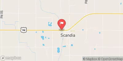
Walden Dam Reservoir Report
Nearby: Nbc Dam Wehrman Dam 1
Last Updated: February 23, 2026
Walden Dam, located in Nelson, Nebraska, is a privately owned structure designed by the USDA NRCS and regulated by the Nebraska Department of Natural Resources.
Summary
Completed in 1939, this earth dam stands at a height of 28 feet and spans 735 feet in length, with a primary purpose of flood risk reduction for the TR-ELK CREEK river. The dam has a storage capacity of 321 acre-feet and a maximum discharge rate of 944 cubic feet per second, making it a crucial asset for managing water resources in the area.
Despite its age, Walden Dam is in fair condition with a low hazard potential, as assessed during its last inspection in March 2020. The dam sits on a foundation of soil with a core made of buttress and stone, contributing to its structural stability. While the dam does not have a spillway or outlet gates, it serves as a key component in mitigating flood risks and protecting the surrounding Nuckolls County community. With its continued state inspections and enforcement measures, Walden Dam remains a vital asset in safeguarding against potential water-related emergencies and ensuring water resource sustainability in the region.
For water resource and climate enthusiasts, Walden Dam presents an intriguing case study of a historic structure designed for flood risk reduction in rural Nebraska. As a privately owned and state-regulated entity, the dam showcases the collaboration between various agencies to manage water resources effectively. With its modest height and capacity, Walden Dam exemplifies the importance of maintaining aging infrastructure to ensure the resilience of communities against natural disasters. As climate change continues to impact water systems, the role of dams like Walden in safeguarding against floods and managing water flow becomes increasingly significant for sustainable water resource management in the future.
°F
°F
mph
Wind
%
Humidity
15-Day Weather Outlook
Year Completed |
1939 |
Dam Length |
735 |
Dam Height |
28 |
River Or Stream |
TR-ELK CREEK |
Primary Dam Type |
Earth |
Hydraulic Height |
28 |
Drainage Area |
2.28 |
Nid Storage |
321 |
Structural Height |
28 |
Hazard Potential |
Low |
Foundations |
Soil |
Nid Height |
28 |
Seasonal Comparison
5-Day Hourly Forecast Detail
Nearby Streamflow Levels
Dam Data Reference
Condition Assessment
SatisfactoryNo existing or potential dam safety deficiencies are recognized. Acceptable performance is expected under all loading conditions (static, hydrologic, seismic) in accordance with the minimum applicable state or federal regulatory criteria or tolerable risk guidelines.
Fair
No existing dam safety deficiencies are recognized for normal operating conditions. Rare or extreme hydrologic and/or seismic events may result in a dam safety deficiency. Risk may be in the range to take further action. Note: Rare or extreme event is defined by the regulatory agency based on their minimum
Poor A dam safety deficiency is recognized for normal operating conditions which may realistically occur. Remedial action is necessary. POOR may also be used when uncertainties exist as to critical analysis parameters which identify a potential dam safety deficiency. Investigations and studies are necessary.
Unsatisfactory
A dam safety deficiency is recognized that requires immediate or emergency remedial action for problem resolution.
Not Rated
The dam has not been inspected, is not under state or federal jurisdiction, or has been inspected but, for whatever reason, has not been rated.
Not Available
Dams for which the condition assessment is restricted to approved government users.
Hazard Potential Classification
HighDams assigned the high hazard potential classification are those where failure or mis-operation will probably cause loss of human life.
Significant
Dams assigned the significant hazard potential classification are those dams where failure or mis-operation results in no probable loss of human life but can cause economic loss, environment damage, disruption of lifeline facilities, or impact other concerns. Significant hazard potential classification dams are often located in predominantly rural or agricultural areas but could be in areas with population and significant infrastructure.
Low
Dams assigned the low hazard potential classification are those where failure or mis-operation results in no probable loss of human life and low economic and/or environmental losses. Losses are principally limited to the owner's property.
Undetermined
Dams for which a downstream hazard potential has not been designated or is not provided.
Not Available
Dams for which the downstream hazard potential is restricted to approved government users.


 Walden Dam