Kaler Dam Reservoir Report
Nearby: Road 728 Dam Garlick Dam
Last Updated: February 21, 2026
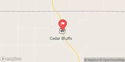
Kaler Dam, located in Nebraska's Frontier County, serves as a vital structure for grade stabilization along the TR-RED WILLOW CREEK.
Summary
Built in 1955, this earth dam stands at 23 feet high and stretches 223 feet in length, providing essential water storage of 66.5 acre-feet. The dam's primary purpose is grade stabilization, ensuring the protection and conservation of water resources in the region. Despite its age, Kaler Dam is in fair condition with a low hazard potential, as confirmed by its last inspection in June 2013.
Managed by the Nebraska Department of Natural Resources, Kaler Dam is subject to state regulations and oversight, with regular inspections and enforcement to ensure its structural integrity and safety. The dam's location in Indianola, Nebraska, makes it a significant asset for water resource management in the area, with a normal storage capacity of 16.9 acre-feet and a drainage area of 3.6 square miles. Additionally, the dam's maximum discharge capacity of 1610 cubic feet per second highlights its importance in flood control and water management strategies in the region. With a history of effective operation and maintenance, Kaler Dam continues to play a crucial role in supporting the local ecosystem and water supply needs.
For water resource and climate enthusiasts, Kaler Dam represents a key infrastructure project that contributes to the sustainable management of water resources in Nebraska. Its design and construction, overseen by state authorities, reflect a commitment to ensuring the dam's functionality and safety for the long term. As a part of the larger water management system along TR-RED WILLOW CREEK, Kaler Dam serves as a vital component in maintaining water quality, reducing erosion, and mitigating flood risks in the region. With ongoing monitoring and maintenance efforts, this earth dam continues to play a crucial role in supporting the environmental health and water security of Frontier County and beyond.
°F
°F
mph
Wind
%
Humidity
15-Day Weather Outlook
Year Completed |
1955 |
Dam Length |
223 |
Dam Height |
23 |
River Or Stream |
TR-RED WILLOW CREEK |
Primary Dam Type |
Earth |
Surface Area |
6.9 |
Hydraulic Height |
23 |
Drainage Area |
3.6 |
Nid Storage |
66.5 |
Structural Height |
23 |
Hazard Potential |
Low |
Foundations |
Soil |
Nid Height |
23 |
Seasonal Comparison
5-Day Hourly Forecast Detail
Nearby Streamflow Levels
Dam Data Reference
Condition Assessment
SatisfactoryNo existing or potential dam safety deficiencies are recognized. Acceptable performance is expected under all loading conditions (static, hydrologic, seismic) in accordance with the minimum applicable state or federal regulatory criteria or tolerable risk guidelines.
Fair
No existing dam safety deficiencies are recognized for normal operating conditions. Rare or extreme hydrologic and/or seismic events may result in a dam safety deficiency. Risk may be in the range to take further action. Note: Rare or extreme event is defined by the regulatory agency based on their minimum
Poor A dam safety deficiency is recognized for normal operating conditions which may realistically occur. Remedial action is necessary. POOR may also be used when uncertainties exist as to critical analysis parameters which identify a potential dam safety deficiency. Investigations and studies are necessary.
Unsatisfactory
A dam safety deficiency is recognized that requires immediate or emergency remedial action for problem resolution.
Not Rated
The dam has not been inspected, is not under state or federal jurisdiction, or has been inspected but, for whatever reason, has not been rated.
Not Available
Dams for which the condition assessment is restricted to approved government users.
Hazard Potential Classification
HighDams assigned the high hazard potential classification are those where failure or mis-operation will probably cause loss of human life.
Significant
Dams assigned the significant hazard potential classification are those dams where failure or mis-operation results in no probable loss of human life but can cause economic loss, environment damage, disruption of lifeline facilities, or impact other concerns. Significant hazard potential classification dams are often located in predominantly rural or agricultural areas but could be in areas with population and significant infrastructure.
Low
Dams assigned the low hazard potential classification are those where failure or mis-operation results in no probable loss of human life and low economic and/or environmental losses. Losses are principally limited to the owner's property.
Undetermined
Dams for which a downstream hazard potential has not been designated or is not provided.
Not Available
Dams for which the downstream hazard potential is restricted to approved government users.
Area Campgrounds
| Location | Reservations | Toilets |
|---|---|---|
 Buffalo Roam Campground
|
||
 Kiwanis Point Campground
|
||
 Red Willow Reservoir State Rec Area
|
||
 Willow View Campground
|


 Kaler Dam