Ruggles Dam Reservoir Report
Last Updated: February 21, 2026
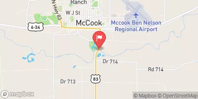
Ruggles Dam, located in Stockville, Nebraska, along TR-Medicine Creek, is a privately owned structure designed by the USDA NRCS to primarily reduce flood risks in the area.
Summary
Completed in 1974, this earth dam stands at a height of 45 feet and has a hydraulic height of 41 feet, with a structural height of 48 feet. The dam has a length of 300 feet and a NID storage capacity of 220 acre-feet, with a normal storage level of 45 acre-feet.
Managed by the Nebraska Department of Natural Resources, Ruggles Dam is regulated, permitted, inspected, and enforced by the state authorities to ensure its safety and compliance with regulations. The dam has a low hazard potential and was last assessed to be in satisfactory condition in April 2019. The structure is equipped to handle a maximum discharge of 1146 cubic feet per second and has an inspection frequency of 5 years to ensure its continued functionality in mitigating flood risks in the region. For water resource and climate enthusiasts, Ruggles Dam serves as a vital infrastructure contributing to the protection and management of water resources in Frontier County, Nebraska.
°F
°F
mph
Wind
%
Humidity
15-Day Weather Outlook
Year Completed |
1974 |
Dam Length |
300 |
Dam Height |
45 |
River Or Stream |
TR-MEDICINE CREEK |
Primary Dam Type |
Earth |
Surface Area |
5 |
Hydraulic Height |
41 |
Drainage Area |
2.1 |
Nid Storage |
220 |
Structural Height |
48 |
Hazard Potential |
Low |
Foundations |
Soil |
Nid Height |
48 |
Seasonal Comparison
5-Day Hourly Forecast Detail
Nearby Streamflow Levels
Dam Data Reference
Condition Assessment
SatisfactoryNo existing or potential dam safety deficiencies are recognized. Acceptable performance is expected under all loading conditions (static, hydrologic, seismic) in accordance with the minimum applicable state or federal regulatory criteria or tolerable risk guidelines.
Fair
No existing dam safety deficiencies are recognized for normal operating conditions. Rare or extreme hydrologic and/or seismic events may result in a dam safety deficiency. Risk may be in the range to take further action. Note: Rare or extreme event is defined by the regulatory agency based on their minimum
Poor A dam safety deficiency is recognized for normal operating conditions which may realistically occur. Remedial action is necessary. POOR may also be used when uncertainties exist as to critical analysis parameters which identify a potential dam safety deficiency. Investigations and studies are necessary.
Unsatisfactory
A dam safety deficiency is recognized that requires immediate or emergency remedial action for problem resolution.
Not Rated
The dam has not been inspected, is not under state or federal jurisdiction, or has been inspected but, for whatever reason, has not been rated.
Not Available
Dams for which the condition assessment is restricted to approved government users.
Hazard Potential Classification
HighDams assigned the high hazard potential classification are those where failure or mis-operation will probably cause loss of human life.
Significant
Dams assigned the significant hazard potential classification are those dams where failure or mis-operation results in no probable loss of human life but can cause economic loss, environment damage, disruption of lifeline facilities, or impact other concerns. Significant hazard potential classification dams are often located in predominantly rural or agricultural areas but could be in areas with population and significant infrastructure.
Low
Dams assigned the low hazard potential classification are those where failure or mis-operation results in no probable loss of human life and low economic and/or environmental losses. Losses are principally limited to the owner's property.
Undetermined
Dams for which a downstream hazard potential has not been designated or is not provided.
Not Available
Dams for which the downstream hazard potential is restricted to approved government users.


 Ruggles Dam