Jurzenski Dam Reservoir Report
Nearby: Miller Dam 425 Oeltjen Dam
Last Updated: January 7, 2026
Jurzenski Dam, located in Howard County, Nebraska, was completed in 1961 by the USDA NRCS with the primary purpose of flood risk reduction along the TR-North Loup River.
°F
°F
mph
Wind
%
Humidity
Summary
This private dam, standing at a height of 21.4 feet and a length of 260 feet, has a storage capacity of 178.3 acre-feet and covers a surface area of 4.6 acres. It is regulated by the Nebraska Department of Natural Resources (DNR) and undergoes inspections every five years to ensure its structural integrity and safety.
Despite its low hazard potential, Jurzenski Dam plays a crucial role in protecting the surrounding area from potential flooding events. Managed by private owners, this earth dam with a stone core serves as a vital infrastructure to manage water resources in the region. With a drainage area of 1.93 square miles and a normal storage capacity of 9.2 acre-feet, the dam contributes to the overall water management efforts in the state.
Situated in a strategic location within the Kansas City District, Jurzenski Dam serves as a testament to effective collaboration between private and public entities in safeguarding communities against flood risks. As water resource and climate enthusiasts, understanding the significance of such infrastructure highlights the importance of proactive measures in mitigating natural disasters and ensuring sustainable water management practices for the future.
Year Completed |
1961 |
Dam Length |
260 |
Dam Height |
21.4 |
River Or Stream |
TR-NORTH LOUP RIVER |
Primary Dam Type |
Earth |
Surface Area |
4.6 |
Hydraulic Height |
21.4 |
Drainage Area |
1.93 |
Nid Storage |
178.3 |
Structural Height |
21.4 |
Hazard Potential |
Low |
Foundations |
Soil |
Nid Height |
21 |
Seasonal Comparison
Weather Forecast
Nearby Streamflow Levels
 North Loup River Nr St Paul Nebr
|
1550cfs |
 Middle Loup R. At St. Paul
|
1110cfs |
 South Loup R At St. Michael
|
149cfs |
 Warm Slough Nr Central City
|
0cfs |
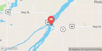 Platte River Near Grand Island
|
733cfs |
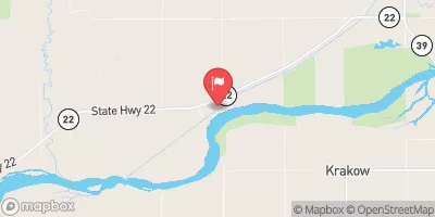 Loup River Power Canal Near Genoa
|
2690cfs |
Dam Data Reference
Condition Assessment
SatisfactoryNo existing or potential dam safety deficiencies are recognized. Acceptable performance is expected under all loading conditions (static, hydrologic, seismic) in accordance with the minimum applicable state or federal regulatory criteria or tolerable risk guidelines.
Fair
No existing dam safety deficiencies are recognized for normal operating conditions. Rare or extreme hydrologic and/or seismic events may result in a dam safety deficiency. Risk may be in the range to take further action. Note: Rare or extreme event is defined by the regulatory agency based on their minimum
Poor A dam safety deficiency is recognized for normal operating conditions which may realistically occur. Remedial action is necessary. POOR may also be used when uncertainties exist as to critical analysis parameters which identify a potential dam safety deficiency. Investigations and studies are necessary.
Unsatisfactory
A dam safety deficiency is recognized that requires immediate or emergency remedial action for problem resolution.
Not Rated
The dam has not been inspected, is not under state or federal jurisdiction, or has been inspected but, for whatever reason, has not been rated.
Not Available
Dams for which the condition assessment is restricted to approved government users.
Hazard Potential Classification
HighDams assigned the high hazard potential classification are those where failure or mis-operation will probably cause loss of human life.
Significant
Dams assigned the significant hazard potential classification are those dams where failure or mis-operation results in no probable loss of human life but can cause economic loss, environment damage, disruption of lifeline facilities, or impact other concerns. Significant hazard potential classification dams are often located in predominantly rural or agricultural areas but could be in areas with population and significant infrastructure.
Low
Dams assigned the low hazard potential classification are those where failure or mis-operation results in no probable loss of human life and low economic and/or environmental losses. Losses are principally limited to the owner's property.
Undetermined
Dams for which a downstream hazard potential has not been designated or is not provided.
Not Available
Dams for which the downstream hazard potential is restricted to approved government users.

 Jurzenski Dam