Wehrspann Dam Reservoir Report
Last Updated: February 23, 2026
Wehrspann Dam, also known as Wehrspann Lake, is a federal-owned structure located in Sarpy, Nebraska, near the city of Omaha.
Summary
Completed in 1983 by the US Army Corps of Engineers, this earth dam serves primarily for flood risk reduction but also provides benefits for fish and wildlife, recreation, and water storage. Standing at a structural height of 87 feet with a hydraulic height of 82 feet, the dam has a storage capacity of 17,164 acre-feet and covers a surface area of 246 acres.
Managed by the US Army Corps of Engineers, Wehrspann Dam is equipped with an uncontrolled spillway and has a maximum discharge capacity of 17,500 cubic feet per second. The dam poses a high hazard potential, and regular inspections are conducted to ensure its safety and effectiveness in managing flood risk. The Corps implements various risk management measures, such as monitoring dam conditions, prioritizing maintenance activities, and engaging with local emergency managers to prepare for potential emergencies. Despite the risks associated with dams and potential flooding events, efforts are continually made to mitigate these risks and ensure public safety.
In the event of severe weather or increased water inflow, the dam may release water to manage levels and prevent structural issues. The Corps works diligently to address all types of flood risk associated with the dam and regularly updates emergency action plans to be prepared for any potential emergencies. With a focus on proactive risk management and community engagement, Wehrspann Dam plays a crucial role in protecting the surrounding area from flooding and ensuring the safety of both the dam and the community it serves.
°F
°F
mph
Wind
%
Humidity
15-Day Weather Outlook
Year Completed |
1983 |
Dam Length |
1810 |
River Or Stream |
TR WEST PAPILLION CREEK BASIN |
Primary Dam Type |
Earth |
Surface Area |
246 |
Hydraulic Height |
82 |
Drainage Area |
13 |
Nid Storage |
17164 |
Structural Height |
87 |
Outlet Gates |
Uncontrolled - 0 |
Hazard Potential |
High |
Foundations |
Soil |
Nid Height |
87 |
Seasonal Comparison
5-Day Hourly Forecast Detail
Nearby Streamflow Levels
 Big Papillion Cr
|
38cfs |
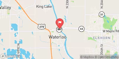
 Elkhorn River At Waterloo
|
1050cfs |
 Platte R At Louisville Ne
|
5930cfs |
 Platte R Nr Ashland
|
6240cfs |
 Missouri River At Omaha
|
15700cfs |
 Wahoo Cr At Ashland
|
83cfs |
Dam Data Reference
Condition Assessment
SatisfactoryNo existing or potential dam safety deficiencies are recognized. Acceptable performance is expected under all loading conditions (static, hydrologic, seismic) in accordance with the minimum applicable state or federal regulatory criteria or tolerable risk guidelines.
Fair
No existing dam safety deficiencies are recognized for normal operating conditions. Rare or extreme hydrologic and/or seismic events may result in a dam safety deficiency. Risk may be in the range to take further action. Note: Rare or extreme event is defined by the regulatory agency based on their minimum
Poor A dam safety deficiency is recognized for normal operating conditions which may realistically occur. Remedial action is necessary. POOR may also be used when uncertainties exist as to critical analysis parameters which identify a potential dam safety deficiency. Investigations and studies are necessary.
Unsatisfactory
A dam safety deficiency is recognized that requires immediate or emergency remedial action for problem resolution.
Not Rated
The dam has not been inspected, is not under state or federal jurisdiction, or has been inspected but, for whatever reason, has not been rated.
Not Available
Dams for which the condition assessment is restricted to approved government users.
Hazard Potential Classification
HighDams assigned the high hazard potential classification are those where failure or mis-operation will probably cause loss of human life.
Significant
Dams assigned the significant hazard potential classification are those dams where failure or mis-operation results in no probable loss of human life but can cause economic loss, environment damage, disruption of lifeline facilities, or impact other concerns. Significant hazard potential classification dams are often located in predominantly rural or agricultural areas but could be in areas with population and significant infrastructure.
Low
Dams assigned the low hazard potential classification are those where failure or mis-operation results in no probable loss of human life and low economic and/or environmental losses. Losses are principally limited to the owner's property.
Undetermined
Dams for which a downstream hazard potential has not been designated or is not provided.
Not Available
Dams for which the downstream hazard potential is restricted to approved government users.
Area Campgrounds
| Location | Reservations | Toilets |
|---|---|---|
 Walnut Creek - Papillion
|
||
 Camp Brewster
|
||
 Louisville Lakes State Rec Area
|

 Wehrspann Dam
 Chalco Hills Recreation Area