Plattsmouth 4-A Reservoir Report
Nearby: Plattsmouth 7-C Plattsmouth 10-A
Last Updated: February 22, 2026
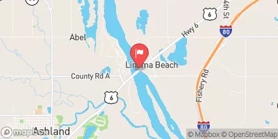
Plattsmouth 4-A is a crucial flood risk reduction structure located in Cass, Nebraska, along the TR-Missouri River.
Summary
Built in 1962 by the USDA NRCS, this earth dam stands at a height of 25 feet and has a hydraulic height of 27 feet, providing essential protection to the surrounding area. With a normal storage capacity of 1 acre-foot and a maximum discharge of 508 cubic feet per second, this dam plays a vital role in managing water flow and reducing the risk of flooding in the region.
Managed by the Nebraska Department of Natural Resources, Plattsmouth 4-A is regularly inspected to ensure its structural integrity and functionality. The dam has been assessed as being in satisfactory condition, with a high hazard potential due to its location and purpose. Emergency action plans are in place, and the dam meets regulatory guidelines to effectively respond to any unforeseen events. With its critical role in flood risk reduction and water resource management, Plattsmouth 4-A stands as a key infrastructure asset in safeguarding the local community and environment from the impacts of extreme weather and climate events.
As a primary purpose flood risk reduction structure, Plattsmouth 4-A serves as a testament to the importance of proactive water resource management in mitigating the effects of climate change. Its strategic design, construction, and regulatory oversight exemplify best practices in dam safety and emergency preparedness. As climate enthusiasts and water resource stakeholders, understanding the significance of infrastructure like Plattsmouth 4-A is essential in fostering resilience and sustainability in the face of changing environmental conditions.
°F
°F
mph
Wind
%
Humidity
15-Day Weather Outlook
Year Completed |
1962 |
Dam Length |
259 |
Dam Height |
25 |
River Or Stream |
TR-MISSOURI RIVER |
Primary Dam Type |
Earth |
Surface Area |
1 |
Hydraulic Height |
27 |
Drainage Area |
0.04 |
Nid Storage |
16 |
Structural Height |
34 |
Hazard Potential |
High |
Foundations |
Soil |
Nid Height |
34 |
Seasonal Comparison
5-Day Hourly Forecast Detail
Nearby Streamflow Levels
 Platte R At Louisville Ne
|
5930cfs |
 Weeping Water Creek At Union
|
18cfs |
 Missouri River At Omaha
|
15700cfs |
 West Nishnabotna River At Randolph
|
274cfs |
 Big Papillion Cr
|
38cfs |
 Platte R Nr Ashland
|
6240cfs |
Dam Data Reference
Condition Assessment
SatisfactoryNo existing or potential dam safety deficiencies are recognized. Acceptable performance is expected under all loading conditions (static, hydrologic, seismic) in accordance with the minimum applicable state or federal regulatory criteria or tolerable risk guidelines.
Fair
No existing dam safety deficiencies are recognized for normal operating conditions. Rare or extreme hydrologic and/or seismic events may result in a dam safety deficiency. Risk may be in the range to take further action. Note: Rare or extreme event is defined by the regulatory agency based on their minimum
Poor A dam safety deficiency is recognized for normal operating conditions which may realistically occur. Remedial action is necessary. POOR may also be used when uncertainties exist as to critical analysis parameters which identify a potential dam safety deficiency. Investigations and studies are necessary.
Unsatisfactory
A dam safety deficiency is recognized that requires immediate or emergency remedial action for problem resolution.
Not Rated
The dam has not been inspected, is not under state or federal jurisdiction, or has been inspected but, for whatever reason, has not been rated.
Not Available
Dams for which the condition assessment is restricted to approved government users.
Hazard Potential Classification
HighDams assigned the high hazard potential classification are those where failure or mis-operation will probably cause loss of human life.
Significant
Dams assigned the significant hazard potential classification are those dams where failure or mis-operation results in no probable loss of human life but can cause economic loss, environment damage, disruption of lifeline facilities, or impact other concerns. Significant hazard potential classification dams are often located in predominantly rural or agricultural areas but could be in areas with population and significant infrastructure.
Low
Dams assigned the low hazard potential classification are those where failure or mis-operation results in no probable loss of human life and low economic and/or environmental losses. Losses are principally limited to the owner's property.
Undetermined
Dams for which a downstream hazard potential has not been designated or is not provided.
Not Available
Dams for which the downstream hazard potential is restricted to approved government users.
Area Campgrounds
| Location | Reservations | Toilets |
|---|---|---|
 Pony Creek Co Park
|
||
 Offutt AFB Military
|
||
 FAMCamp
|
||
 Haworth City Park - Bellevue
|
||
 Glenwood Lake Park
|
||
 Camp Wakonda
|

 Plattsmouth 4-A
 Plattsmouth Boat Ramp