Road Dam Rs-17-1(103) Reservoir Report
Nearby: Kugler Dam 1171 Korell Dam
Last Updated: December 22, 2025
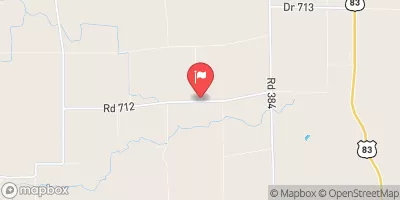
Road Dam Rs-17-1(103) in Hitchcock County, Nebraska, stands as a vital piece of infrastructure managed by the state, specifically the NE DNR.
°F
°F
mph
Wind
%
Humidity
Summary
Completed in 1981, this earth dam serves multiple purposes, including flood risk reduction, and has a height of 40 feet with a storage capacity of 296 acre-feet. Situated along the TR-Republican River, this dam plays a crucial role in regulating water flow and protecting the surrounding area from potential flooding events.
With a low hazard potential and a satisfactory condition assessment as of June 2018, Road Dam Rs-17-1(103) is a reliable structure that undergoes regular inspections every five years. The dam's design features stone core and soil foundation, contributing to its stability and longevity. Despite its age, the dam continues to meet regulatory standards and fulfill its intended functions effectively, showcasing the importance of proper maintenance and oversight in water resource management.
Managed by the state and located in a strategic position within the river system, Road Dam Rs-17-1(103) exemplifies the intersection of engineering, environmental protection, and climate resilience. With its efficient design and satisfactory condition, this dam serves as a testament to effective water infrastructure management in mitigating flood risks and ensuring the safety of communities downstream. As water resource and climate enthusiasts, understanding the significance of structures like Road Dam Rs-17-1(103) is essential in appreciating the interconnectedness of water management and environmental sustainability.
Year Completed |
1981 |
Dam Length |
970 |
Dam Height |
40 |
River Or Stream |
TR-REPUBLICAN RIVER |
Primary Dam Type |
Earth |
Surface Area |
20 |
Hydraulic Height |
40 |
Drainage Area |
0.4 |
Nid Storage |
296 |
Structural Height |
40 |
Hazard Potential |
Low |
Foundations |
Soil |
Nid Height |
40 |
Seasonal Comparison
Weather Forecast
Nearby Streamflow Levels
Dam Data Reference
Condition Assessment
SatisfactoryNo existing or potential dam safety deficiencies are recognized. Acceptable performance is expected under all loading conditions (static, hydrologic, seismic) in accordance with the minimum applicable state or federal regulatory criteria or tolerable risk guidelines.
Fair
No existing dam safety deficiencies are recognized for normal operating conditions. Rare or extreme hydrologic and/or seismic events may result in a dam safety deficiency. Risk may be in the range to take further action. Note: Rare or extreme event is defined by the regulatory agency based on their minimum
Poor A dam safety deficiency is recognized for normal operating conditions which may realistically occur. Remedial action is necessary. POOR may also be used when uncertainties exist as to critical analysis parameters which identify a potential dam safety deficiency. Investigations and studies are necessary.
Unsatisfactory
A dam safety deficiency is recognized that requires immediate or emergency remedial action for problem resolution.
Not Rated
The dam has not been inspected, is not under state or federal jurisdiction, or has been inspected but, for whatever reason, has not been rated.
Not Available
Dams for which the condition assessment is restricted to approved government users.
Hazard Potential Classification
HighDams assigned the high hazard potential classification are those where failure or mis-operation will probably cause loss of human life.
Significant
Dams assigned the significant hazard potential classification are those dams where failure or mis-operation results in no probable loss of human life but can cause economic loss, environment damage, disruption of lifeline facilities, or impact other concerns. Significant hazard potential classification dams are often located in predominantly rural or agricultural areas but could be in areas with population and significant infrastructure.
Low
Dams assigned the low hazard potential classification are those where failure or mis-operation results in no probable loss of human life and low economic and/or environmental losses. Losses are principally limited to the owner's property.
Undetermined
Dams for which a downstream hazard potential has not been designated or is not provided.
Not Available
Dams for which the downstream hazard potential is restricted to approved government users.


 Road Dam Rs-17-1(103)