South Branch 36 Reservoir Report
Nearby: South Branch 84 Retzlaff Dam
Last Updated: February 22, 2026
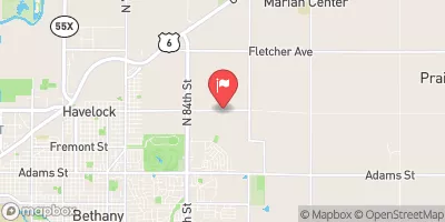
South Branch 36 is a crucial flood risk reduction structure located in Otoe County, Nebraska.
Summary
Constructed in 1987 by USDA NRCS, this earth dam stands at a height of 28 feet and spans a length of 935 feet, providing a storage capacity of 140 acre-feet. With a primary purpose of flood risk reduction, South Branch 36 plays a significant role in protecting the surrounding area from potential water-related disasters.
Managed and regulated by the Nebraska Department of Natural Resources, South Branch 36 is subject to state inspection, permitting, and enforcement to ensure its structural integrity and compliance with safety standards. The dam has been assessed as having a low hazard potential and is deemed to be in satisfactory condition as of the last inspection in September 2016. Its location on the TR-S FK Little Nemaha River contributes to its vital role in managing water flow and mitigating flood risks in the region.
Water resource and climate enthusiasts will appreciate the engineering details of South Branch 36, including its stone core and soil foundation construction. The dam's maximum discharge capacity of 325 cubic feet per second, along with its drainage area of 0.8 square miles, showcases its ability to effectively manage water flow during periods of high precipitation. As a key component of the local government's flood risk reduction strategy, South Branch 36 stands as a testament to the importance of sustainable water resource management in safeguarding communities against the impacts of climate change.
°F
°F
mph
Wind
%
Humidity
15-Day Weather Outlook
Year Completed |
1987 |
Dam Length |
935 |
Dam Height |
28 |
River Or Stream |
TR-S FK LITTLE NEMAHA RIVER |
Primary Dam Type |
Earth |
Surface Area |
5 |
Hydraulic Height |
28 |
Drainage Area |
0.8 |
Nid Storage |
140 |
Structural Height |
32 |
Hazard Potential |
Low |
Foundations |
Soil |
Nid Height |
32 |
Seasonal Comparison
5-Day Hourly Forecast Detail
Nearby Streamflow Levels
Dam Data Reference
Condition Assessment
SatisfactoryNo existing or potential dam safety deficiencies are recognized. Acceptable performance is expected under all loading conditions (static, hydrologic, seismic) in accordance with the minimum applicable state or federal regulatory criteria or tolerable risk guidelines.
Fair
No existing dam safety deficiencies are recognized for normal operating conditions. Rare or extreme hydrologic and/or seismic events may result in a dam safety deficiency. Risk may be in the range to take further action. Note: Rare or extreme event is defined by the regulatory agency based on their minimum
Poor A dam safety deficiency is recognized for normal operating conditions which may realistically occur. Remedial action is necessary. POOR may also be used when uncertainties exist as to critical analysis parameters which identify a potential dam safety deficiency. Investigations and studies are necessary.
Unsatisfactory
A dam safety deficiency is recognized that requires immediate or emergency remedial action for problem resolution.
Not Rated
The dam has not been inspected, is not under state or federal jurisdiction, or has been inspected but, for whatever reason, has not been rated.
Not Available
Dams for which the condition assessment is restricted to approved government users.
Hazard Potential Classification
HighDams assigned the high hazard potential classification are those where failure or mis-operation will probably cause loss of human life.
Significant
Dams assigned the significant hazard potential classification are those dams where failure or mis-operation results in no probable loss of human life but can cause economic loss, environment damage, disruption of lifeline facilities, or impact other concerns. Significant hazard potential classification dams are often located in predominantly rural or agricultural areas but could be in areas with population and significant infrastructure.
Low
Dams assigned the low hazard potential classification are those where failure or mis-operation results in no probable loss of human life and low economic and/or environmental losses. Losses are principally limited to the owner's property.
Undetermined
Dams for which a downstream hazard potential has not been designated or is not provided.
Not Available
Dams for which the downstream hazard potential is restricted to approved government users.


 South Branch 36