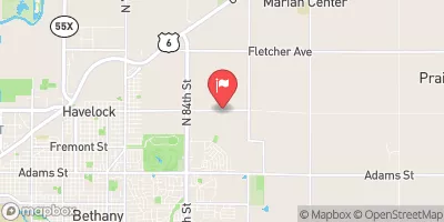
South Branch 7 Reservoir Report
Nearby: South Branch 8 Little Nemaha 10
Last Updated: February 22, 2026
South Branch 7, located in Burr, Nebraska, is a crucial part of flood risk reduction efforts in the area.
Summary
Built in 1992 by the USDA NRCS, this earth dam stands at a height of 48 feet and has a hydraulic height of 45 feet, providing protection to the surrounding region along the TR-S FK Little Nemaha River. With a normal storage capacity of 412 acre-feet and a drainage area of 8.8 square miles, South Branch 7 plays a vital role in managing water flow and minimizing the impact of potential flooding events.
Managed by the Nebraska Department of Natural Resources, South Branch 7 has a low hazard potential and is assessed as being in satisfactory condition as of June 2016. This structure, with a structural height of 61 feet and a length of 2290 feet, not only helps control the flow of water but also serves as a habitat for wildlife and enhances the overall ecosystem of the area. With its primary purpose being flood risk reduction, South Branch 7 exemplifies the collaborative efforts between local government agencies, the USDA NRCS, and the Nebraska DNR in safeguarding communities and the environment from the impacts of extreme weather events.
As a key component in the flood management infrastructure of Otoe County, Nebraska, South Branch 7 is a testament to the importance of proactive water resource management in the face of changing climate patterns. With its satisfactory condition and regular inspection schedule, this earth dam continues to fulfill its role in protecting the surrounding area from the potential devastation of flooding events. As climate enthusiasts and water resource advocates, understanding and supporting the maintenance and upkeep of structures like South Branch 7 is essential for building resilience in the face of a changing climate and increasing water-related challenges.
°F
°F
mph
Wind
%
Humidity
15-Day Weather Outlook
Year Completed |
1992 |
Dam Length |
2290 |
Dam Height |
48 |
River Or Stream |
TR-S FK LITTLE NEMAHA RIVER |
Primary Dam Type |
Earth |
Surface Area |
53 |
Hydraulic Height |
45 |
Drainage Area |
8.8 |
Nid Storage |
3186.8 |
Structural Height |
61 |
Hazard Potential |
Low |
Foundations |
Soil |
Nid Height |
61 |
Seasonal Comparison
5-Day Hourly Forecast Detail
Nearby Streamflow Levels
Dam Data Reference
Condition Assessment
SatisfactoryNo existing or potential dam safety deficiencies are recognized. Acceptable performance is expected under all loading conditions (static, hydrologic, seismic) in accordance with the minimum applicable state or federal regulatory criteria or tolerable risk guidelines.
Fair
No existing dam safety deficiencies are recognized for normal operating conditions. Rare or extreme hydrologic and/or seismic events may result in a dam safety deficiency. Risk may be in the range to take further action. Note: Rare or extreme event is defined by the regulatory agency based on their minimum
Poor A dam safety deficiency is recognized for normal operating conditions which may realistically occur. Remedial action is necessary. POOR may also be used when uncertainties exist as to critical analysis parameters which identify a potential dam safety deficiency. Investigations and studies are necessary.
Unsatisfactory
A dam safety deficiency is recognized that requires immediate or emergency remedial action for problem resolution.
Not Rated
The dam has not been inspected, is not under state or federal jurisdiction, or has been inspected but, for whatever reason, has not been rated.
Not Available
Dams for which the condition assessment is restricted to approved government users.
Hazard Potential Classification
HighDams assigned the high hazard potential classification are those where failure or mis-operation will probably cause loss of human life.
Significant
Dams assigned the significant hazard potential classification are those dams where failure or mis-operation results in no probable loss of human life but can cause economic loss, environment damage, disruption of lifeline facilities, or impact other concerns. Significant hazard potential classification dams are often located in predominantly rural or agricultural areas but could be in areas with population and significant infrastructure.
Low
Dams assigned the low hazard potential classification are those where failure or mis-operation results in no probable loss of human life and low economic and/or environmental losses. Losses are principally limited to the owner's property.
Undetermined
Dams for which a downstream hazard potential has not been designated or is not provided.
Not Available
Dams for which the downstream hazard potential is restricted to approved government users.


 South Branch 7