South Branch 2-2 Reservoir Report
Nearby: Borland Dam South Branch 3-3
Last Updated: February 22, 2026
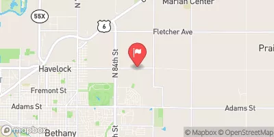
South Branch 2-2 is a local government-owned earth dam located in Burr, Nebraska, within the Otoe County.
Summary
Constructed by the USDA NRCS in 1992, this structure serves primarily for flood risk reduction along the TR-S FK Little Nemaha River. With a height of 29 feet and a length of 935 feet, the dam has a storage capacity of 163 acre-feet and a drainage area of 0.7 square miles.
Managed by the Nebraska Department of Natural Resources, South Branch 2-2 has a low hazard potential and is in satisfactory condition based on a 2016 assessment. The dam has a hydraulic height of 27 feet and a structural height of 33 feet, providing essential protection to the surrounding area. Despite its critical purpose, the dam is currently not under the authority of any federal agency and has not undergone recent modifications or emergency action plan updates.
For water resource and climate enthusiasts, South Branch 2-2 serves as a vital infrastructure for flood control in the region, showcasing the collaborative effort between local and state agencies to ensure the safety and resilience of the community. With its stone core and soil foundation, this earth dam stands as a testament to the importance of sustainable water management practices in safeguarding against natural disasters and preserving the integrity of the Little Nemaha River watershed.
°F
°F
mph
Wind
%
Humidity
15-Day Weather Outlook
Year Completed |
1992 |
Dam Length |
935 |
Dam Height |
29 |
River Or Stream |
TR-S FK LITTLE NEMAHA RIVER |
Primary Dam Type |
Earth |
Surface Area |
11 |
Hydraulic Height |
27 |
Drainage Area |
0.7 |
Nid Storage |
163 |
Structural Height |
33 |
Hazard Potential |
Low |
Foundations |
Soil |
Nid Height |
33 |
Seasonal Comparison
5-Day Hourly Forecast Detail
Nearby Streamflow Levels
Dam Data Reference
Condition Assessment
SatisfactoryNo existing or potential dam safety deficiencies are recognized. Acceptable performance is expected under all loading conditions (static, hydrologic, seismic) in accordance with the minimum applicable state or federal regulatory criteria or tolerable risk guidelines.
Fair
No existing dam safety deficiencies are recognized for normal operating conditions. Rare or extreme hydrologic and/or seismic events may result in a dam safety deficiency. Risk may be in the range to take further action. Note: Rare or extreme event is defined by the regulatory agency based on their minimum
Poor A dam safety deficiency is recognized for normal operating conditions which may realistically occur. Remedial action is necessary. POOR may also be used when uncertainties exist as to critical analysis parameters which identify a potential dam safety deficiency. Investigations and studies are necessary.
Unsatisfactory
A dam safety deficiency is recognized that requires immediate or emergency remedial action for problem resolution.
Not Rated
The dam has not been inspected, is not under state or federal jurisdiction, or has been inspected but, for whatever reason, has not been rated.
Not Available
Dams for which the condition assessment is restricted to approved government users.
Hazard Potential Classification
HighDams assigned the high hazard potential classification are those where failure or mis-operation will probably cause loss of human life.
Significant
Dams assigned the significant hazard potential classification are those dams where failure or mis-operation results in no probable loss of human life but can cause economic loss, environment damage, disruption of lifeline facilities, or impact other concerns. Significant hazard potential classification dams are often located in predominantly rural or agricultural areas but could be in areas with population and significant infrastructure.
Low
Dams assigned the low hazard potential classification are those where failure or mis-operation results in no probable loss of human life and low economic and/or environmental losses. Losses are principally limited to the owner's property.
Undetermined
Dams for which a downstream hazard potential has not been designated or is not provided.
Not Available
Dams for which the downstream hazard potential is restricted to approved government users.


 South Branch 2-2