Mccue South Dam Reservoir Report
Nearby: Mccue North Dam Hammond Dam 7917
Last Updated: February 22, 2026
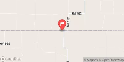
Mccue South Dam, located in Hendley, Nebraska, is a state-regulated earth dam completed in 1950 with a primary purpose of fire protection, stock, or small fish pond.
Summary
This dam stands at a height of 12.7 meters and has a storage capacity of 54.1 acre-feet, with a normal storage level of 18.2 acre-feet. Situated on TR-Beaver Creek, the dam serves as a vital resource for water management in the area, with a drainage area of 2.4 square kilometers and a maximum discharge capacity of 800 cubic feet per second.
Despite its low hazard potential, the dam's condition assessment is marked as poor, with the last inspection conducted in August 2018. The dam's current state raises concerns regarding its structural integrity and the potential risks it poses to the surrounding community. With the Nebraska Department of Natural Resources (NE DNR) overseeing regulation, inspection, and enforcement, it is imperative that necessary measures are taken to address the dam's condition and ensure the safety of the area's residents and water resources. Enthusiasts of water resources and climate change must monitor the situation closely and advocate for timely maintenance and improvements to mitigate any potential risks associated with Mccue South Dam.
°F
°F
mph
Wind
%
Humidity
15-Day Weather Outlook
Year Completed |
1950 |
Dam Length |
208 |
Dam Height |
12.7 |
River Or Stream |
TR-BEAVER CREEK |
Primary Dam Type |
Earth |
Surface Area |
7 |
Hydraulic Height |
12.7 |
Drainage Area |
2.4 |
Nid Storage |
54.1 |
Structural Height |
12.7 |
Hazard Potential |
Low |
Foundations |
Soil |
Nid Height |
13 |
Seasonal Comparison
5-Day Hourly Forecast Detail
Nearby Streamflow Levels
Dam Data Reference
Condition Assessment
SatisfactoryNo existing or potential dam safety deficiencies are recognized. Acceptable performance is expected under all loading conditions (static, hydrologic, seismic) in accordance with the minimum applicable state or federal regulatory criteria or tolerable risk guidelines.
Fair
No existing dam safety deficiencies are recognized for normal operating conditions. Rare or extreme hydrologic and/or seismic events may result in a dam safety deficiency. Risk may be in the range to take further action. Note: Rare or extreme event is defined by the regulatory agency based on their minimum
Poor A dam safety deficiency is recognized for normal operating conditions which may realistically occur. Remedial action is necessary. POOR may also be used when uncertainties exist as to critical analysis parameters which identify a potential dam safety deficiency. Investigations and studies are necessary.
Unsatisfactory
A dam safety deficiency is recognized that requires immediate or emergency remedial action for problem resolution.
Not Rated
The dam has not been inspected, is not under state or federal jurisdiction, or has been inspected but, for whatever reason, has not been rated.
Not Available
Dams for which the condition assessment is restricted to approved government users.
Hazard Potential Classification
HighDams assigned the high hazard potential classification are those where failure or mis-operation will probably cause loss of human life.
Significant
Dams assigned the significant hazard potential classification are those dams where failure or mis-operation results in no probable loss of human life but can cause economic loss, environment damage, disruption of lifeline facilities, or impact other concerns. Significant hazard potential classification dams are often located in predominantly rural or agricultural areas but could be in areas with population and significant infrastructure.
Low
Dams assigned the low hazard potential classification are those where failure or mis-operation results in no probable loss of human life and low economic and/or environmental losses. Losses are principally limited to the owner's property.
Undetermined
Dams for which a downstream hazard potential has not been designated or is not provided.
Not Available
Dams for which the downstream hazard potential is restricted to approved government users.


 Mccue South Dam