Janet Bentley Dam Reservoir Report
Last Updated: January 3, 2026
Janet Bentley Dam, located in Neligh, Nebraska, along the TR-Hail Creek, was completed in 2006 by the USDA NRCS.
°F
°F
mph
Wind
%
Humidity
Summary
This privately owned earth dam stands at a height of 22 feet with a hydraulic height of 22 feet and a structural height of 25 feet. Its primary purpose is flood risk reduction, with a storage capacity of 152 acre-feet and a drainage area of 2.4 square miles. The dam has a low hazard potential and was last inspected in May 2017, receiving a satisfactory condition assessment.
Despite being a relatively small structure, Janet Bentley Dam plays a crucial role in mitigating flood risks in the Antelope County area. With its stone core and soil foundation, the dam spans 333 feet in length and covers a surface area of 11 acres. It is regulated by the Nebraska Department of Natural Resources and undergoes regular inspections and enforcement to ensure its safety and effectiveness in flood control. The dam is an essential part of the local water resource management system, providing protection to the surrounding community and infrastructure against potential flood events.
Janet Bentley Dam's strategic location and design contribute to its successful performance in flood risk reduction. With its low hazard potential, satisfactory condition assessment, and adherence to state regulations, the dam serves as a reliable asset in maintaining the safety and resilience of the Antelope County region. As climate change continues to impact water resources and weather patterns, the presence of well-maintained structures like Janet Bentley Dam becomes increasingly vital in safeguarding communities and ecosystems from the threats of flooding and water-related disasters.
Year Completed |
2006 |
Dam Length |
333 |
Dam Height |
22 |
River Or Stream |
TR-HAIL CREEK |
Primary Dam Type |
Earth |
Surface Area |
11 |
Hydraulic Height |
22 |
Drainage Area |
2.4 |
Nid Storage |
152 |
Structural Height |
25 |
Hazard Potential |
Low |
Foundations |
Soil |
Nid Height |
25 |
Seasonal Comparison
Weather Forecast
Nearby Streamflow Levels
 Elkhorn River At Ewing
|
89cfs |
 North Fork Elkhorn River Near Pierce
|
96cfs |
 Bazile Creek At Center
|
85cfs |
 Verdigre C Nr Verdigre
|
206cfs |
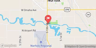 Elkhorn R At Norfolk Ne
|
440cfs |
 Niobrara River Nr. Verdel
|
517cfs |
Dam Data Reference
Condition Assessment
SatisfactoryNo existing or potential dam safety deficiencies are recognized. Acceptable performance is expected under all loading conditions (static, hydrologic, seismic) in accordance with the minimum applicable state or federal regulatory criteria or tolerable risk guidelines.
Fair
No existing dam safety deficiencies are recognized for normal operating conditions. Rare or extreme hydrologic and/or seismic events may result in a dam safety deficiency. Risk may be in the range to take further action. Note: Rare or extreme event is defined by the regulatory agency based on their minimum
Poor A dam safety deficiency is recognized for normal operating conditions which may realistically occur. Remedial action is necessary. POOR may also be used when uncertainties exist as to critical analysis parameters which identify a potential dam safety deficiency. Investigations and studies are necessary.
Unsatisfactory
A dam safety deficiency is recognized that requires immediate or emergency remedial action for problem resolution.
Not Rated
The dam has not been inspected, is not under state or federal jurisdiction, or has been inspected but, for whatever reason, has not been rated.
Not Available
Dams for which the condition assessment is restricted to approved government users.
Hazard Potential Classification
HighDams assigned the high hazard potential classification are those where failure or mis-operation will probably cause loss of human life.
Significant
Dams assigned the significant hazard potential classification are those dams where failure or mis-operation results in no probable loss of human life but can cause economic loss, environment damage, disruption of lifeline facilities, or impact other concerns. Significant hazard potential classification dams are often located in predominantly rural or agricultural areas but could be in areas with population and significant infrastructure.
Low
Dams assigned the low hazard potential classification are those where failure or mis-operation results in no probable loss of human life and low economic and/or environmental losses. Losses are principally limited to the owner's property.
Undetermined
Dams for which a downstream hazard potential has not been designated or is not provided.
Not Available
Dams for which the downstream hazard potential is restricted to approved government users.

 Janet Bentley Dam