Shafer Dam Reservoir Report
Last Updated: February 22, 2026
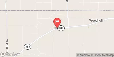
Shafer Dam, located in Hollinger, Nebraska, serves as a crucial structure for flood risk reduction along TR-Beaver Creek.
Summary
Built in 1960, this private-owned earth dam stands at a height of 15.4 feet and has a storage capacity of 78.5 acre-feet. Despite its low hazard potential, the dam's condition assessment in 2017 revealed poor conditions, prompting the need for further inspection and maintenance.
With a drainage area of 1.19 square miles and a normal storage capacity of 37 acre-feet, Shafer Dam plays a vital role in managing water flow and protecting the surrounding area from potential flooding. The dam's poor condition assessment highlights the importance of regular monitoring and maintenance to ensure its continued effectiveness in flood risk reduction. The dam's location in Furnas County, Nebraska, underscores its significance in safeguarding the local community and environment.
As climate change continues to impact water resources and weather patterns, the maintenance and upkeep of dams like Shafer Dam become even more critical. With the potential for increased precipitation and extreme weather events, ensuring the structural integrity and functionality of flood risk reduction infrastructure is essential for protecting both the environment and local communities. Shafer Dam stands as a reminder of the ongoing need for proactive management and investment in water resource infrastructure to adapt to changing climate conditions.
°F
°F
mph
Wind
%
Humidity
15-Day Weather Outlook
Year Completed |
1960 |
Dam Length |
200 |
Dam Height |
15.4 |
River Or Stream |
TR-BEAVER CREEK |
Primary Dam Type |
Earth |
Surface Area |
8.8 |
Hydraulic Height |
15.4 |
Drainage Area |
1.19 |
Nid Storage |
78.5 |
Structural Height |
15.4 |
Hazard Potential |
Low |
Foundations |
Soil |
Nid Height |
15 |
Seasonal Comparison
5-Day Hourly Forecast Detail
Nearby Streamflow Levels
 Beaver Creek Near Beaver City
|
0cfs |
 Sappa C Nr Lyle
|
3cfs |
 Sappa Creek Near Stamford
|
13cfs |
 Republican River Near Orleans
|
98cfs |
 Prairie Dog C Nr Woodruff
|
2cfs |
 Republican River At Cambridge
|
60cfs |
Dam Data Reference
Condition Assessment
SatisfactoryNo existing or potential dam safety deficiencies are recognized. Acceptable performance is expected under all loading conditions (static, hydrologic, seismic) in accordance with the minimum applicable state or federal regulatory criteria or tolerable risk guidelines.
Fair
No existing dam safety deficiencies are recognized for normal operating conditions. Rare or extreme hydrologic and/or seismic events may result in a dam safety deficiency. Risk may be in the range to take further action. Note: Rare or extreme event is defined by the regulatory agency based on their minimum
Poor A dam safety deficiency is recognized for normal operating conditions which may realistically occur. Remedial action is necessary. POOR may also be used when uncertainties exist as to critical analysis parameters which identify a potential dam safety deficiency. Investigations and studies are necessary.
Unsatisfactory
A dam safety deficiency is recognized that requires immediate or emergency remedial action for problem resolution.
Not Rated
The dam has not been inspected, is not under state or federal jurisdiction, or has been inspected but, for whatever reason, has not been rated.
Not Available
Dams for which the condition assessment is restricted to approved government users.
Hazard Potential Classification
HighDams assigned the high hazard potential classification are those where failure or mis-operation will probably cause loss of human life.
Significant
Dams assigned the significant hazard potential classification are those dams where failure or mis-operation results in no probable loss of human life but can cause economic loss, environment damage, disruption of lifeline facilities, or impact other concerns. Significant hazard potential classification dams are often located in predominantly rural or agricultural areas but could be in areas with population and significant infrastructure.
Low
Dams assigned the low hazard potential classification are those where failure or mis-operation results in no probable loss of human life and low economic and/or environmental losses. Losses are principally limited to the owner's property.
Undetermined
Dams for which a downstream hazard potential has not been designated or is not provided.
Not Available
Dams for which the downstream hazard potential is restricted to approved government users.

 Shafer Dam