Pawnee Lake Dam Reservoir Report
Nearby: Ohmstede Dam Watson Dam
Last Updated: February 23, 2026
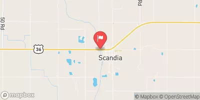
Pawnee Lake Dam, located in Guide Rock, Nebraska, is a key structure managed by the local government for flood risk reduction along the TR-Republican River.
Summary
Completed in 1960, this earth dam stands at a height of 6.9 feet and has a storage capacity of 211.6 acre-feet, with a normal storage level of 93.1 acre-feet. The dam spans 1620 feet in length, serving its primary purpose of flood risk reduction effectively.
Managed by the Nebraska Department of Natural Resources, Pawnee Lake Dam is regulated and inspected by state authorities to ensure its structural integrity and safety. Despite being classified as having a low hazard potential, the dam's condition assessment is currently marked as "Not Rated," with the last inspection taking place in April 2018. With a solid track record of state oversight and enforcement, Pawnee Lake Dam remains a vital infrastructure piece in the region's water resource management system, contributing to the overall safety and resilience of the area.
With its strategic location and function, Pawnee Lake Dam plays a crucial role in mitigating flood risks and protecting the surrounding communities. As climate change continues to impact water resources and weather patterns, the importance of well-maintained infrastructure like Pawnee Lake Dam becomes increasingly evident. As such, ongoing monitoring and maintenance efforts are essential to ensure the continued effectiveness and safety of this critical piece of water resource infrastructure in Webster County, Nebraska.
°F
°F
mph
Wind
%
Humidity
15-Day Weather Outlook
Year Completed |
1960 |
Dam Length |
1620 |
Dam Height |
6.9 |
River Or Stream |
TR-REPUBLICAN RIVER |
Primary Dam Type |
Earth |
Surface Area |
38 |
Hydraulic Height |
6.9 |
Drainage Area |
0.4 |
Nid Storage |
211.6 |
Structural Height |
6.9 |
Hazard Potential |
Low |
Foundations |
Soil |
Nid Height |
7 |
Seasonal Comparison
5-Day Hourly Forecast Detail
Nearby Streamflow Levels
Dam Data Reference
Condition Assessment
SatisfactoryNo existing or potential dam safety deficiencies are recognized. Acceptable performance is expected under all loading conditions (static, hydrologic, seismic) in accordance with the minimum applicable state or federal regulatory criteria or tolerable risk guidelines.
Fair
No existing dam safety deficiencies are recognized for normal operating conditions. Rare or extreme hydrologic and/or seismic events may result in a dam safety deficiency. Risk may be in the range to take further action. Note: Rare or extreme event is defined by the regulatory agency based on their minimum
Poor A dam safety deficiency is recognized for normal operating conditions which may realistically occur. Remedial action is necessary. POOR may also be used when uncertainties exist as to critical analysis parameters which identify a potential dam safety deficiency. Investigations and studies are necessary.
Unsatisfactory
A dam safety deficiency is recognized that requires immediate or emergency remedial action for problem resolution.
Not Rated
The dam has not been inspected, is not under state or federal jurisdiction, or has been inspected but, for whatever reason, has not been rated.
Not Available
Dams for which the condition assessment is restricted to approved government users.
Hazard Potential Classification
HighDams assigned the high hazard potential classification are those where failure or mis-operation will probably cause loss of human life.
Significant
Dams assigned the significant hazard potential classification are those dams where failure or mis-operation results in no probable loss of human life but can cause economic loss, environment damage, disruption of lifeline facilities, or impact other concerns. Significant hazard potential classification dams are often located in predominantly rural or agricultural areas but could be in areas with population and significant infrastructure.
Low
Dams assigned the low hazard potential classification are those where failure or mis-operation results in no probable loss of human life and low economic and/or environmental losses. Losses are principally limited to the owner's property.
Undetermined
Dams for which a downstream hazard potential has not been designated or is not provided.
Not Available
Dams for which the downstream hazard potential is restricted to approved government users.


 Pawnee Lake Dam