Rutt Herefords Dam Reservoir Report
Nearby: Volk Dam Bertrand Dam
Last Updated: February 24, 2026
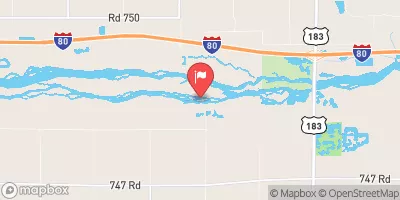
Rutt Herefords Dam, located in Franklin, Nebraska, is a privately-owned structure designed for flood risk reduction along the TR-W BR Thompson Creek.
Summary
Built in 1960, this earth dam stands at a height of 20.1 feet and has a storage capacity of 67.6 acre-feet, with a normal storage level of 46.7 acre-feet. The dam's surface area covers 8.3 acres, serving a drainage area of 0.38 square miles.
Managed by the Nebraska Department of Natural Resources, Rutt Herefords Dam has a low hazard potential and is currently rated as "Not Rated" in terms of condition assessment. With state regulation, inspection, and enforcement in place, the dam ensures the safety of surrounding areas in the event of flooding. Despite its age, the dam continues to fulfill its primary purpose of flood risk reduction, safeguarding the local community and environment from potential water-related disasters.
As a significant infrastructure in flood management, Rutt Herefords Dam plays a crucial role in maintaining water resources and climate resilience in the region. With its strategic location and design, the dam stands as a testament to effective engineering and proactive measures for mitigating flood risks. As water resource and climate enthusiasts, the data surrounding this dam offers valuable insights into the importance of sustainable infrastructure for ensuring the safety and well-being of communities in the face of changing environmental conditions.
°F
°F
mph
Wind
%
Humidity
15-Day Weather Outlook
Year Completed |
1960 |
Dam Length |
300 |
Dam Height |
20.1 |
River Or Stream |
TR-W BR THOMPSON CREEK |
Primary Dam Type |
Earth |
Surface Area |
8.3 |
Hydraulic Height |
20.1 |
Drainage Area |
0.38 |
Nid Storage |
67.6 |
Structural Height |
20.1 |
Hazard Potential |
Low |
Foundations |
Soil |
Nid Height |
20 |
Seasonal Comparison
5-Day Hourly Forecast Detail
Nearby Streamflow Levels
 Platte River Near Kearney
|
556cfs |
 Republican River Near Orleans
|
97cfs |
 Sappa Creek Near Stamford
|
9cfs |
 Prairie Dog C Nr Woodruff
|
1cfs |
 Republican River At Guide Rock
|
77cfs |
 Platte R Mid Ch
|
281cfs |
Dam Data Reference
Condition Assessment
SatisfactoryNo existing or potential dam safety deficiencies are recognized. Acceptable performance is expected under all loading conditions (static, hydrologic, seismic) in accordance with the minimum applicable state or federal regulatory criteria or tolerable risk guidelines.
Fair
No existing dam safety deficiencies are recognized for normal operating conditions. Rare or extreme hydrologic and/or seismic events may result in a dam safety deficiency. Risk may be in the range to take further action. Note: Rare or extreme event is defined by the regulatory agency based on their minimum
Poor A dam safety deficiency is recognized for normal operating conditions which may realistically occur. Remedial action is necessary. POOR may also be used when uncertainties exist as to critical analysis parameters which identify a potential dam safety deficiency. Investigations and studies are necessary.
Unsatisfactory
A dam safety deficiency is recognized that requires immediate or emergency remedial action for problem resolution.
Not Rated
The dam has not been inspected, is not under state or federal jurisdiction, or has been inspected but, for whatever reason, has not been rated.
Not Available
Dams for which the condition assessment is restricted to approved government users.
Hazard Potential Classification
HighDams assigned the high hazard potential classification are those where failure or mis-operation will probably cause loss of human life.
Significant
Dams assigned the significant hazard potential classification are those dams where failure or mis-operation results in no probable loss of human life but can cause economic loss, environment damage, disruption of lifeline facilities, or impact other concerns. Significant hazard potential classification dams are often located in predominantly rural or agricultural areas but could be in areas with population and significant infrastructure.
Low
Dams assigned the low hazard potential classification are those where failure or mis-operation results in no probable loss of human life and low economic and/or environmental losses. Losses are principally limited to the owner's property.
Undetermined
Dams for which a downstream hazard potential has not been designated or is not provided.
Not Available
Dams for which the downstream hazard potential is restricted to approved government users.

 Rutt Herefords Dam