Meline Dam Reservoir Report
Last Updated: February 24, 2026
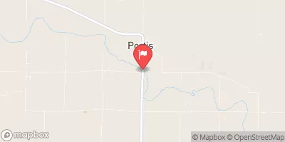
Meline Dam, located in Inavale, Nebraska, along the TR-Farmers Creek, was completed in 1960 with the primary purpose of flood risk reduction.
Summary
Owned by a private entity, this earth dam stands at a height of 14.6 feet and has a storage capacity of 68 acre-feet. With a low hazard potential, the dam's condition assessment remains unrated as of its last inspection in April 2017.
Managed by the Nebraska Department of Natural Resources, Meline Dam serves as a vital infrastructure for mitigating flood risks in the Webster County area. The dam's design, constructed with stone core and soil foundations, spans a length of 550 feet and covers a surface area of 2.3 acres. Despite its age, the dam continues to meet state regulatory standards for inspection, enforcement, and permitting, ensuring its operational effectiveness and safety.
For water resource and climate enthusiasts, Meline Dam represents a pivotal structure in the local watershed management system. With its strategic location and purposeful design, the dam not only provides flood protection but also contributes to the sustainable utilization of water resources in the region. As a key element in the flood risk reduction strategy, Meline Dam stands as a testament to the importance of proactive infrastructure development in adapting to changing climate conditions and safeguarding communities against natural disasters.
°F
°F
mph
Wind
%
Humidity
15-Day Weather Outlook
Year Completed |
1960 |
Dam Length |
550 |
Dam Height |
14.6 |
River Or Stream |
TR-FARMERS CREEK |
Primary Dam Type |
Earth |
Surface Area |
2.3 |
Hydraulic Height |
14.6 |
Drainage Area |
0.55 |
Nid Storage |
68 |
Structural Height |
14.6 |
Hazard Potential |
Low |
Foundations |
Soil |
Nid Height |
15 |
Seasonal Comparison
5-Day Hourly Forecast Detail
Nearby Streamflow Levels
Dam Data Reference
Condition Assessment
SatisfactoryNo existing or potential dam safety deficiencies are recognized. Acceptable performance is expected under all loading conditions (static, hydrologic, seismic) in accordance with the minimum applicable state or federal regulatory criteria or tolerable risk guidelines.
Fair
No existing dam safety deficiencies are recognized for normal operating conditions. Rare or extreme hydrologic and/or seismic events may result in a dam safety deficiency. Risk may be in the range to take further action. Note: Rare or extreme event is defined by the regulatory agency based on their minimum
Poor A dam safety deficiency is recognized for normal operating conditions which may realistically occur. Remedial action is necessary. POOR may also be used when uncertainties exist as to critical analysis parameters which identify a potential dam safety deficiency. Investigations and studies are necessary.
Unsatisfactory
A dam safety deficiency is recognized that requires immediate or emergency remedial action for problem resolution.
Not Rated
The dam has not been inspected, is not under state or federal jurisdiction, or has been inspected but, for whatever reason, has not been rated.
Not Available
Dams for which the condition assessment is restricted to approved government users.
Hazard Potential Classification
HighDams assigned the high hazard potential classification are those where failure or mis-operation will probably cause loss of human life.
Significant
Dams assigned the significant hazard potential classification are those dams where failure or mis-operation results in no probable loss of human life but can cause economic loss, environment damage, disruption of lifeline facilities, or impact other concerns. Significant hazard potential classification dams are often located in predominantly rural or agricultural areas but could be in areas with population and significant infrastructure.
Low
Dams assigned the low hazard potential classification are those where failure or mis-operation results in no probable loss of human life and low economic and/or environmental losses. Losses are principally limited to the owner's property.
Undetermined
Dams for which a downstream hazard potential has not been designated or is not provided.
Not Available
Dams for which the downstream hazard potential is restricted to approved government users.


 Meline Dam