Koch Dam 4052 Reservoir Report
Nearby: Brockmeier Dam Getty Dam
Last Updated: February 22, 2026
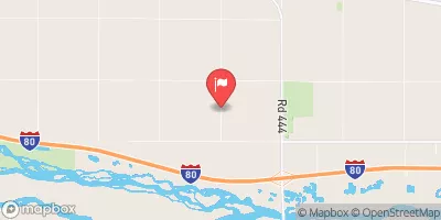
Koch Dam 4052, located in Frontier, Nebraska, along TR-ELDER CREEK, was completed in 1980 for the primary purpose of flood risk reduction.
Summary
This private dam is state-regulated by the Nebraska Department of Natural Resources (NE DNR) and has a low hazard potential. Standing at a height of 12.8 feet with a length of 410 feet, the dam has a storage capacity of 94 acre-feet and covers a surface area of 15.9 acres.
Despite being designated as "Not Rated" in terms of condition assessment, Koch Dam 4052 has undergone inspections every 10 years, with the last assessment conducted in August 2017. The dam's structure primarily consists of earth and stone, built on a soil foundation. Owned by a private entity, the dam falls under state jurisdiction and is subject to state permitting, inspection, and enforcement. Its location in SWS35T7R24W makes it a vital asset for mitigating flood risks in the area.
With Adrian Smith (R) as the Congressional Representative overseeing the region, Koch Dam 4052 plays a crucial role in safeguarding the local community from potential flooding events. Its strategic positioning and operational capabilities contribute to the overall water resource management and climate resilience efforts in Frontier, Nebraska. As water resource and climate enthusiasts, staying informed about the dam's status and regulatory framework can provide valuable insights into the region's flood risk reduction strategies and emergency preparedness measures.
°F
°F
mph
Wind
%
Humidity
15-Day Weather Outlook
Year Completed |
1980 |
Dam Length |
410 |
Dam Height |
12.8 |
River Or Stream |
TR-ELDER CREEK |
Primary Dam Type |
Earth |
Surface Area |
15.9 |
Hydraulic Height |
12.8 |
Drainage Area |
1.07 |
Nid Storage |
94 |
Structural Height |
12.8 |
Hazard Potential |
Low |
Foundations |
Soil |
Nid Height |
13 |
Seasonal Comparison
5-Day Hourly Forecast Detail
Nearby Streamflow Levels
Dam Data Reference
Condition Assessment
SatisfactoryNo existing or potential dam safety deficiencies are recognized. Acceptable performance is expected under all loading conditions (static, hydrologic, seismic) in accordance with the minimum applicable state or federal regulatory criteria or tolerable risk guidelines.
Fair
No existing dam safety deficiencies are recognized for normal operating conditions. Rare or extreme hydrologic and/or seismic events may result in a dam safety deficiency. Risk may be in the range to take further action. Note: Rare or extreme event is defined by the regulatory agency based on their minimum
Poor A dam safety deficiency is recognized for normal operating conditions which may realistically occur. Remedial action is necessary. POOR may also be used when uncertainties exist as to critical analysis parameters which identify a potential dam safety deficiency. Investigations and studies are necessary.
Unsatisfactory
A dam safety deficiency is recognized that requires immediate or emergency remedial action for problem resolution.
Not Rated
The dam has not been inspected, is not under state or federal jurisdiction, or has been inspected but, for whatever reason, has not been rated.
Not Available
Dams for which the condition assessment is restricted to approved government users.
Hazard Potential Classification
HighDams assigned the high hazard potential classification are those where failure or mis-operation will probably cause loss of human life.
Significant
Dams assigned the significant hazard potential classification are those dams where failure or mis-operation results in no probable loss of human life but can cause economic loss, environment damage, disruption of lifeline facilities, or impact other concerns. Significant hazard potential classification dams are often located in predominantly rural or agricultural areas but could be in areas with population and significant infrastructure.
Low
Dams assigned the low hazard potential classification are those where failure or mis-operation results in no probable loss of human life and low economic and/or environmental losses. Losses are principally limited to the owner's property.
Undetermined
Dams for which a downstream hazard potential has not been designated or is not provided.
Not Available
Dams for which the downstream hazard potential is restricted to approved government users.


 Koch Dam 4052