Mike Chatt Dam 3 Reservoir Report
Last Updated: January 7, 2026
Mike Chatt Dam 3 in Nebraska, designed by USDA NRCS, serves as a vital flood risk reduction structure along TR-CARR CREEK.
°F
°F
mph
Wind
%
Humidity
Summary
Completed in 2011, this private Earth dam stands at a height of 28.2 feet and has a structural height of 31.6 feet, providing essential protection for the surrounding area. With a maximum storage capacity of 34.9 acre-feet and a normal storage of 18.8 acre-feet, the dam plays a crucial role in managing water resources in the region.
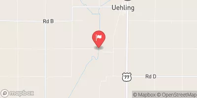
Situated in Burt County, Nebraska, Mike Chatt Dam 3 covers a surface area of 2.4 acres and has a drainage area of 0.28 square miles. Despite its low hazard potential, the dam is regularly inspected by NE DNR to ensure its structural integrity and efficacy in flood control. With a satisfactory condition assessment as of October 2019, this dam exemplifies modern engineering practices in water resource management. Enthusiasts of water resources and climate will appreciate the importance of this dam in safeguarding the local community against potential flooding events.
As a key component of flood risk reduction efforts, Mike Chatt Dam 3 stands as a testament to the collaborative efforts between private entities and regulatory agencies in ensuring the safety and resilience of water infrastructure. With its strategic location and effective design, this Earth dam serves as a critical defense mechanism against potential disasters, highlighting the significance of proactive measures in water resource management. For enthusiasts passionate about sustainable water practices and climate resilience, Mike Chatt Dam 3 represents a beacon of innovation and dedication towards safeguarding communities and ecosystems in the face of changing environmental conditions.
Year Completed |
2011 |
Dam Length |
175 |
Dam Height |
28.2 |
River Or Stream |
TR-CARR CREEK |
Primary Dam Type |
Earth |
Surface Area |
2.4 |
Hydraulic Height |
28.1 |
Drainage Area |
0.28 |
Nid Storage |
34.9 |
Structural Height |
31.6 |
Hazard Potential |
Low |
Foundations |
Soil |
Nid Height |
32 |
Seasonal Comparison
Weather Forecast
Nearby Streamflow Levels
 Logan Creek Near Uehling
|
359cfs |
 Maple Creek Near Nickerson
|
65cfs |
 Soldier River At Pisgah
|
112cfs |
 Missouri River At Decatur
|
15300cfs |
 Monona-Harrison Ditch Near Turin
|
158cfs |
 Little Sioux River Near Turin
|
1040cfs |
Dam Data Reference
Condition Assessment
SatisfactoryNo existing or potential dam safety deficiencies are recognized. Acceptable performance is expected under all loading conditions (static, hydrologic, seismic) in accordance with the minimum applicable state or federal regulatory criteria or tolerable risk guidelines.
Fair
No existing dam safety deficiencies are recognized for normal operating conditions. Rare or extreme hydrologic and/or seismic events may result in a dam safety deficiency. Risk may be in the range to take further action. Note: Rare or extreme event is defined by the regulatory agency based on their minimum
Poor A dam safety deficiency is recognized for normal operating conditions which may realistically occur. Remedial action is necessary. POOR may also be used when uncertainties exist as to critical analysis parameters which identify a potential dam safety deficiency. Investigations and studies are necessary.
Unsatisfactory
A dam safety deficiency is recognized that requires immediate or emergency remedial action for problem resolution.
Not Rated
The dam has not been inspected, is not under state or federal jurisdiction, or has been inspected but, for whatever reason, has not been rated.
Not Available
Dams for which the condition assessment is restricted to approved government users.
Hazard Potential Classification
HighDams assigned the high hazard potential classification are those where failure or mis-operation will probably cause loss of human life.
Significant
Dams assigned the significant hazard potential classification are those dams where failure or mis-operation results in no probable loss of human life but can cause economic loss, environment damage, disruption of lifeline facilities, or impact other concerns. Significant hazard potential classification dams are often located in predominantly rural or agricultural areas but could be in areas with population and significant infrastructure.
Low
Dams assigned the low hazard potential classification are those where failure or mis-operation results in no probable loss of human life and low economic and/or environmental losses. Losses are principally limited to the owner's property.
Undetermined
Dams for which a downstream hazard potential has not been designated or is not provided.
Not Available
Dams for which the downstream hazard potential is restricted to approved government users.

 Mike Chatt Dam 3