Grazers Inc Dam Reservoir Report
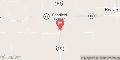
Nearby: Grazers Inc Dam 8116 Andrews Dam 3664
Last Updated: February 22, 2026
Grazers INC Dam, located in Furnas, Nebraska, is a privately owned structure built in 1980 for flood risk reduction purposes along the TR-Republican River.
Summary
Standing at a height of 16.9 feet with a hydraulic height of 14 feet, this earth-type dam has a storage capacity of 55.8 acre-feet and covers a surface area of 3.6 acres. Despite its low hazard potential, the dam is regulated by the Nebraska Department of Natural Resources and undergoes regular inspections to ensure its structural integrity.
Owned and operated by a private entity, Grazers INC Dam plays a vital role in managing water resources and mitigating flood risks in the region. The dam's primary purpose, in addition to flood risk reduction, is categorized as 'Other', reflecting its multifunctional role in water management. Although its condition assessment is currently rated as 'Not Rated', the dam's last inspection in September 2018 confirmed its safety and compliance with state regulatory standards. This dam is a crucial component of the local water infrastructure, providing essential protection to the surrounding community and ecosystem.
With its strategic location and design, Grazers INC Dam serves as a key asset in the water management system of Furnas, Nebraska. As part of a larger network of structures along the TR-Republican River, this dam contributes to the overall resilience of the region against potential water-related hazards. Its low hazard potential, coupled with regular inspections and state regulatory oversight, ensures that Grazers INC Dam continues to fulfill its vital functions in safeguarding the local environment and communities from the impacts of extreme weather events and water resource challenges.
°F
°F
mph
Wind
%
Humidity
15-Day Weather Outlook
Year Completed |
1980 |
Dam Length |
200 |
Dam Height |
16.9 |
River Or Stream |
TR-REPUBLICAN RIVER |
Primary Dam Type |
Earth |
Surface Area |
3.6 |
Hydraulic Height |
14 |
Drainage Area |
0.78 |
Nid Storage |
55.8 |
Structural Height |
16.9 |
Hazard Potential |
Low |
Foundations |
Soil |
Nid Height |
17 |
Seasonal Comparison
5-Day Hourly Forecast Detail
Nearby Streamflow Levels
Dam Data Reference
Condition Assessment
SatisfactoryNo existing or potential dam safety deficiencies are recognized. Acceptable performance is expected under all loading conditions (static, hydrologic, seismic) in accordance with the minimum applicable state or federal regulatory criteria or tolerable risk guidelines.
Fair
No existing dam safety deficiencies are recognized for normal operating conditions. Rare or extreme hydrologic and/or seismic events may result in a dam safety deficiency. Risk may be in the range to take further action. Note: Rare or extreme event is defined by the regulatory agency based on their minimum
Poor A dam safety deficiency is recognized for normal operating conditions which may realistically occur. Remedial action is necessary. POOR may also be used when uncertainties exist as to critical analysis parameters which identify a potential dam safety deficiency. Investigations and studies are necessary.
Unsatisfactory
A dam safety deficiency is recognized that requires immediate or emergency remedial action for problem resolution.
Not Rated
The dam has not been inspected, is not under state or federal jurisdiction, or has been inspected but, for whatever reason, has not been rated.
Not Available
Dams for which the condition assessment is restricted to approved government users.
Hazard Potential Classification
HighDams assigned the high hazard potential classification are those where failure or mis-operation will probably cause loss of human life.
Significant
Dams assigned the significant hazard potential classification are those dams where failure or mis-operation results in no probable loss of human life but can cause economic loss, environment damage, disruption of lifeline facilities, or impact other concerns. Significant hazard potential classification dams are often located in predominantly rural or agricultural areas but could be in areas with population and significant infrastructure.
Low
Dams assigned the low hazard potential classification are those where failure or mis-operation results in no probable loss of human life and low economic and/or environmental losses. Losses are principally limited to the owner's property.
Undetermined
Dams for which a downstream hazard potential has not been designated or is not provided.
Not Available
Dams for which the downstream hazard potential is restricted to approved government users.


 Grazers Inc Dam