Schmidt Dam Reservoir Report
Nearby: Woollen Farms Dam Boehler Dam
Last Updated: February 23, 2026
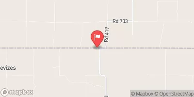
Schmidt Dam, located in Alma, Nebraska, is a local government-owned structure on Cook Creek that serves multiple purposes, including flood risk reduction.
Summary
Built in 1980, this earth dam stands at a height of 28.2 feet and has a storage capacity of 594.5 acre-feet. With a low hazard potential and a condition assessment that is currently not rated, Schmidt Dam plays a crucial role in protecting the surrounding area from potential flooding events.
Managed by the Nebraska Department of Natural Resources, Schmidt Dam undergoes regular inspections and is equipped with state-regulated permitting, inspection, and enforcement measures. Its primary purpose extends beyond flood risk reduction to other beneficial functions for the local community. The dam's strategic location and design contribute to its effectiveness in managing water resources and safeguarding the area against potential risks associated with climate variations and extreme weather events.
As a key infrastructure within the region, Schmidt Dam provides essential water resource management capabilities, including regulating water flow, storing excess water, and mitigating flood risks. Its presence underscores the importance of proactive measures in climate adaptation and resilience, highlighting the crucial role that dams play in enhancing water security and protecting communities from the impacts of changing environmental conditions.
°F
°F
mph
Wind
%
Humidity
15-Day Weather Outlook
Year Completed |
1980 |
Dam Length |
680 |
Dam Height |
28.2 |
River Or Stream |
COOK CREEK |
Primary Dam Type |
Earth |
Surface Area |
2.6 |
Hydraulic Height |
28.2 |
Drainage Area |
4.41 |
Nid Storage |
594.5 |
Structural Height |
28.2 |
Hazard Potential |
Low |
Foundations |
Soil |
Nid Height |
28 |
Seasonal Comparison
5-Day Hourly Forecast Detail
Nearby Streamflow Levels
 Republican River Near Orleans
|
97cfs |
 Sappa Creek Near Stamford
|
9cfs |
 Prairie Dog C Nr Woodruff
|
1cfs |
 Beaver Creek Near Beaver City
|
0cfs |
 Nf Solomon R At Glade
|
9cfs |
 Sappa C Nr Lyle
|
4cfs |
Dam Data Reference
Condition Assessment
SatisfactoryNo existing or potential dam safety deficiencies are recognized. Acceptable performance is expected under all loading conditions (static, hydrologic, seismic) in accordance with the minimum applicable state or federal regulatory criteria or tolerable risk guidelines.
Fair
No existing dam safety deficiencies are recognized for normal operating conditions. Rare or extreme hydrologic and/or seismic events may result in a dam safety deficiency. Risk may be in the range to take further action. Note: Rare or extreme event is defined by the regulatory agency based on their minimum
Poor A dam safety deficiency is recognized for normal operating conditions which may realistically occur. Remedial action is necessary. POOR may also be used when uncertainties exist as to critical analysis parameters which identify a potential dam safety deficiency. Investigations and studies are necessary.
Unsatisfactory
A dam safety deficiency is recognized that requires immediate or emergency remedial action for problem resolution.
Not Rated
The dam has not been inspected, is not under state or federal jurisdiction, or has been inspected but, for whatever reason, has not been rated.
Not Available
Dams for which the condition assessment is restricted to approved government users.
Hazard Potential Classification
HighDams assigned the high hazard potential classification are those where failure or mis-operation will probably cause loss of human life.
Significant
Dams assigned the significant hazard potential classification are those dams where failure or mis-operation results in no probable loss of human life but can cause economic loss, environment damage, disruption of lifeline facilities, or impact other concerns. Significant hazard potential classification dams are often located in predominantly rural or agricultural areas but could be in areas with population and significant infrastructure.
Low
Dams assigned the low hazard potential classification are those where failure or mis-operation results in no probable loss of human life and low economic and/or environmental losses. Losses are principally limited to the owner's property.
Undetermined
Dams for which a downstream hazard potential has not been designated or is not provided.
Not Available
Dams for which the downstream hazard potential is restricted to approved government users.

 Methodist Cove - Harlan County Lake
 Orleans City RV Park
 Hunter Cove - Harlan County Lake
 Gremlin Cove - Harlan County Lake
 North Outlet - Harlan County Lake
 Patterson Harbor Marina Campground
 Schmidt Dam
 Harlan County Lake Near Republican City
 Harlan - Alma boat ramp