
Weber Creek Subwatershed Site 5-2832 Reservoir Report
Last Updated: December 14, 2025
Weber Creek Subwatershed Site 5-2832, located in Woodbury, Iowa, is a low-hazard earth dam completed in 1955 for fire protection, stock, and small fish pond purposes.
°F
°F
mph
Wind
%
Humidity
Summary
Managed by local government, this site falls under the regulatory oversight of the Iowa Department of Natural Resources, with state permitting, inspection, and enforcement in place to ensure its safety and compliance. With a storage capacity of 65 acre-feet and a drainage area of 0.3 square miles, the dam serves as a flood risk reduction measure on TR-Weber Creek, part of the Omaha District.
Despite its low hazard potential and moderate risk assessment, the condition of Weber Creek Subwatershed Site 5-2832 has not been rated. The dam, standing at a height of 21 feet and a length of 555 feet, has a normal storage capacity of 7 acre-feet and a surface area of 3 acres. Spillway type is uncontrolled, with no outlet gates or associated structures reported. While emergency action plans and risk management measures are not specified, the site remains a crucial component in the local water resource management infrastructure, providing essential benefits for both human and ecological needs in the region.
Year Completed |
1955 |
Dam Length |
555 |
Dam Height |
21 |
River Or Stream |
TR- WEBER CREEK |
Primary Dam Type |
Earth |
Surface Area |
3 |
Drainage Area |
0.3 |
Nid Storage |
65 |
Hazard Potential |
Low |
Foundations |
Soil |
Nid Height |
21 |
Seasonal Comparison
Weather Forecast
Nearby Streamflow Levels
 West Fork Ditch At Hornick
|
80cfs |
 Maple River At Mapleton
|
323cfs |
 Monona-Harrison Ditch Near Turin
|
158cfs |
 Little Sioux River Near Turin
|
1040cfs |
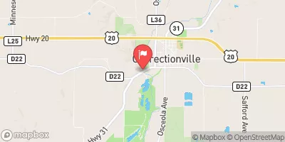 Little Sioux River At Correctionville
|
327cfs |
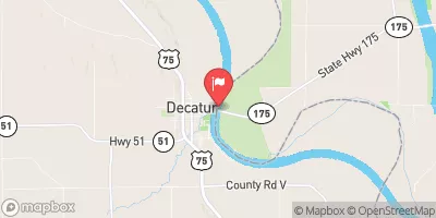 Missouri River At Decatur
|
15500cfs |
Dam Data Reference
Condition Assessment
SatisfactoryNo existing or potential dam safety deficiencies are recognized. Acceptable performance is expected under all loading conditions (static, hydrologic, seismic) in accordance with the minimum applicable state or federal regulatory criteria or tolerable risk guidelines.
Fair
No existing dam safety deficiencies are recognized for normal operating conditions. Rare or extreme hydrologic and/or seismic events may result in a dam safety deficiency. Risk may be in the range to take further action. Note: Rare or extreme event is defined by the regulatory agency based on their minimum
Poor A dam safety deficiency is recognized for normal operating conditions which may realistically occur. Remedial action is necessary. POOR may also be used when uncertainties exist as to critical analysis parameters which identify a potential dam safety deficiency. Investigations and studies are necessary.
Unsatisfactory
A dam safety deficiency is recognized that requires immediate or emergency remedial action for problem resolution.
Not Rated
The dam has not been inspected, is not under state or federal jurisdiction, or has been inspected but, for whatever reason, has not been rated.
Not Available
Dams for which the condition assessment is restricted to approved government users.
Hazard Potential Classification
HighDams assigned the high hazard potential classification are those where failure or mis-operation will probably cause loss of human life.
Significant
Dams assigned the significant hazard potential classification are those dams where failure or mis-operation results in no probable loss of human life but can cause economic loss, environment damage, disruption of lifeline facilities, or impact other concerns. Significant hazard potential classification dams are often located in predominantly rural or agricultural areas but could be in areas with population and significant infrastructure.
Low
Dams assigned the low hazard potential classification are those where failure or mis-operation results in no probable loss of human life and low economic and/or environmental losses. Losses are principally limited to the owner's property.
Undetermined
Dams for which a downstream hazard potential has not been designated or is not provided.
Not Available
Dams for which the downstream hazard potential is restricted to approved government users.
 Weber Creek Subwatershed Site 5-2832