Rodgers Dam Reservoir Report
Nearby: Pitt Dam Big Five Dam
Last Updated: December 25, 2025
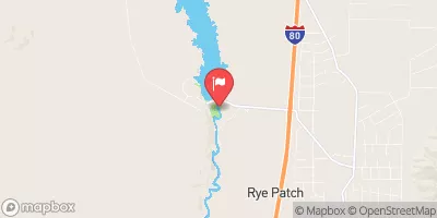
Rodgers Dam, located in Pershing, Nevada, serves as a crucial water management infrastructure along the Humboldt River.
°F
°F
mph
Wind
%
Humidity
Summary
Built in 2008 for irrigation purposes, this private-owned Earth dam stands at 20 feet high with a hydraulic height of 15 feet and a structural height of 30 feet. It has a storage capacity of 50 acre-feet, with a normal storage level of 47 acre-feet and a surface area of 13.5 acres.
With a controlled spillway width of 65 feet and a maximum discharge of 9250 cubic feet per second, Rodgers Dam has been deemed to have a low hazard potential and a fair condition assessment as of September 2021. Despite its relatively low risk, the dam is under the jurisdiction of the Nevada Department of Water Resources and undergoes regular inspections every five years to ensure its structural integrity and safety. The dam also features five outlet gates, including four roller gates and one slide gate for efficient water release.
Rodgers Dam plays a vital role in managing water resources in the region, supporting agricultural activities and providing a reliable water supply for the surrounding areas. Its strategic location and design make it a key component in the water infrastructure network along the Humboldt River, contributing to the overall sustainability and resilience of the local water supply system.
Year Completed |
2008 |
Dam Length |
100 |
Dam Height |
20 |
River Or Stream |
HUMBOLDT RIVER-OS |
Primary Dam Type |
Earth |
Surface Area |
13.5 |
Hydraulic Height |
15 |
Drainage Area |
999 |
Nid Storage |
50 |
Structural Height |
30 |
Outlet Gates |
Roller - 4, Slide (sluice gate) - 1 |
Hazard Potential |
Low |
Foundations |
Soil |
Nid Height |
30 |
Seasonal Comparison
Weather Forecast
Nearby Streamflow Levels
Dam Data Reference
Condition Assessment
SatisfactoryNo existing or potential dam safety deficiencies are recognized. Acceptable performance is expected under all loading conditions (static, hydrologic, seismic) in accordance with the minimum applicable state or federal regulatory criteria or tolerable risk guidelines.
Fair
No existing dam safety deficiencies are recognized for normal operating conditions. Rare or extreme hydrologic and/or seismic events may result in a dam safety deficiency. Risk may be in the range to take further action. Note: Rare or extreme event is defined by the regulatory agency based on their minimum
Poor A dam safety deficiency is recognized for normal operating conditions which may realistically occur. Remedial action is necessary. POOR may also be used when uncertainties exist as to critical analysis parameters which identify a potential dam safety deficiency. Investigations and studies are necessary.
Unsatisfactory
A dam safety deficiency is recognized that requires immediate or emergency remedial action for problem resolution.
Not Rated
The dam has not been inspected, is not under state or federal jurisdiction, or has been inspected but, for whatever reason, has not been rated.
Not Available
Dams for which the condition assessment is restricted to approved government users.
Hazard Potential Classification
HighDams assigned the high hazard potential classification are those where failure or mis-operation will probably cause loss of human life.
Significant
Dams assigned the significant hazard potential classification are those dams where failure or mis-operation results in no probable loss of human life but can cause economic loss, environment damage, disruption of lifeline facilities, or impact other concerns. Significant hazard potential classification dams are often located in predominantly rural or agricultural areas but could be in areas with population and significant infrastructure.
Low
Dams assigned the low hazard potential classification are those where failure or mis-operation results in no probable loss of human life and low economic and/or environmental losses. Losses are principally limited to the owner's property.
Undetermined
Dams for which a downstream hazard potential has not been designated or is not provided.
Not Available
Dams for which the downstream hazard potential is restricted to approved government users.

 Rodgers Dam