Lake Winnipesaukee At Weirs Beach Reservoir Report
Nearby: Avery Pheasant Ridge Cc Pond Dam
Last Updated: February 25, 2026
Lake Winnipesaukee is located in central New Hampshire and is the largest lake in the state.
Summary
Weirs Beach is a popular tourist spot located on the southern shore of the lake, which features several recreational activities including boating and swimming. The lake has a rich history dating back to the Native American tribes who first inhabited the area, and later played an important role in the logging and milling industries. The lake's hydrology is influenced by its many tributaries, including the Merrimack River and several smaller streams, and is also affected by the snowpack during the winter months. The lake is a popular destination for fishing and water sports, and is also used for agricultural irrigation.
°F
°F
mph
Wind
%
Humidity
15-Day Weather Outlook
Reservoir Details
| Gage Height, Ft 24hr Change | None% |
| Percent of Normal | None% |
| Minimum |
2.72 ft
2016-09-19 |
| Maximum |
4.5 ft
2017-06-09 |
| Average | ft |
Seasonal Comparison
Temperature, Water, °C Levels
Gage Height, Ft Levels
Specific Conductance, Water, Unfiltered, Microsiemens Per Centimeter At 25°C Levels
Dissolved Oxygen, Water, Unfiltered, Mg/L Levels
Ph, Water, Unfiltered, Field, Standard Units Levels
5-Day Hourly Forecast Detail
Nearby Streamflow Levels
 Winnipesaukee River At Tilton
|
164cfs |
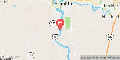
 Merrimack River At Franklin Junction
|
1210cfs |
 Smith River Near Bristol
|
41cfs |
 Pemigewasset River At Plymouth
|
1860cfs |
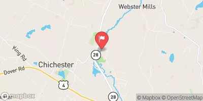
 Suncook River At North Chichester
|
153cfs |
 Blackwater River Near Webster
|
19cfs |
Dam Data Reference
Condition Assessment
SatisfactoryNo existing or potential dam safety deficiencies are recognized. Acceptable performance is expected under all loading conditions (static, hydrologic, seismic) in accordance with the minimum applicable state or federal regulatory criteria or tolerable risk guidelines.
Fair
No existing dam safety deficiencies are recognized for normal operating conditions. Rare or extreme hydrologic and/or seismic events may result in a dam safety deficiency. Risk may be in the range to take further action. Note: Rare or extreme event is defined by the regulatory agency based on their minimum
Poor A dam safety deficiency is recognized for normal operating conditions which may realistically occur. Remedial action is necessary. POOR may also be used when uncertainties exist as to critical analysis parameters which identify a potential dam safety deficiency. Investigations and studies are necessary.
Unsatisfactory
A dam safety deficiency is recognized that requires immediate or emergency remedial action for problem resolution.
Not Rated
The dam has not been inspected, is not under state or federal jurisdiction, or has been inspected but, for whatever reason, has not been rated.
Not Available
Dams for which the condition assessment is restricted to approved government users.
Hazard Potential Classification
HighDams assigned the high hazard potential classification are those where failure or mis-operation will probably cause loss of human life.
Significant
Dams assigned the significant hazard potential classification are those dams where failure or mis-operation results in no probable loss of human life but can cause economic loss, environment damage, disruption of lifeline facilities, or impact other concerns. Significant hazard potential classification dams are often located in predominantly rural or agricultural areas but could be in areas with population and significant infrastructure.
Low
Dams assigned the low hazard potential classification are those where failure or mis-operation results in no probable loss of human life and low economic and/or environmental losses. Losses are principally limited to the owner's property.
Undetermined
Dams for which a downstream hazard potential has not been designated or is not provided.
Not Available
Dams for which the downstream hazard potential is restricted to approved government users.
Area Campgrounds
| Location | Reservations | Toilets |
|---|---|---|
 Heron Cove
|
||
 Wister #4
|
||
 Wister #1
|
||
 Wister #3
|
||
 Wister #2
|
||
 Owl's Landing Campground
|

 Lakeport
 Lake Winnipesaukee At Weirs Beach
 Bell Street Lakeport
 Begins In Franklin To Sewall'S Island