
Buckhaven #1 Reservoir Report
Nearby: Burch Indian Creek
Last Updated: December 10, 2025
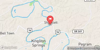
Buckhaven #1 is a privately owned dam located in Humphreys, Tennessee, along the Little Hurricane river.
°F
°F
mph
Wind
%
Humidity
Summary
Constructed in 1990, this earth dam stands at a height of 29 feet with a hydraulic height of 26 feet, providing a storage capacity of 42 acre-feet. With a surface area of 2.4 acres and a drainage area of 0.09 square miles, Buckhaven #1 serves as a vital water resource in the region.
Managed by the Tennessee Safe Dams Program, Buckhaven #1 has a low hazard potential and is rated as being in satisfactory condition as of the last inspection in November 2019. The dam features an uncontrolled spillway and has no outlet gates. Despite its moderate risk assessment rating, the dam has not had any significant modifications or emergency action plans prepared, highlighting the importance of continued monitoring and maintenance to ensure its reliability in the face of changing climate conditions.
As water resource and climate enthusiasts, understanding the intricacies of infrastructure like Buckhaven #1 is crucial for mitigating potential risks and ensuring sustainable management of water resources. By staying informed about the state of dams like Buckhaven #1, we can work towards fostering resilience in the face of climate change and safeguarding our water supply for future generations.
Year Completed |
1990 |
Dam Length |
170 |
River Or Stream |
LITTLE HURRICANE |
Primary Dam Type |
Earth |
Surface Area |
2.4 |
Hydraulic Height |
26 |
Drainage Area |
0.09 |
Nid Storage |
42 |
Structural Height |
29 |
Outlet Gates |
None |
Hazard Potential |
Low |
Nid Height |
29 |
Seasonal Comparison
Weather Forecast
Nearby Streamflow Levels
 Piney River At Vernon
|
99cfs |
 Duck River Above Hurricane Mills
|
2450cfs |
 Duck River At Hwy 100 At Centerville
|
1900cfs |
 Buffalo River Below Lobelville
|
552cfs |
 Yellow Creek At Ellis Mills
|
39cfs |
 Harpeth River Near Kingston Springs
|
425cfs |
Dam Data Reference
Condition Assessment
SatisfactoryNo existing or potential dam safety deficiencies are recognized. Acceptable performance is expected under all loading conditions (static, hydrologic, seismic) in accordance with the minimum applicable state or federal regulatory criteria or tolerable risk guidelines.
Fair
No existing dam safety deficiencies are recognized for normal operating conditions. Rare or extreme hydrologic and/or seismic events may result in a dam safety deficiency. Risk may be in the range to take further action. Note: Rare or extreme event is defined by the regulatory agency based on their minimum
Poor A dam safety deficiency is recognized for normal operating conditions which may realistically occur. Remedial action is necessary. POOR may also be used when uncertainties exist as to critical analysis parameters which identify a potential dam safety deficiency. Investigations and studies are necessary.
Unsatisfactory
A dam safety deficiency is recognized that requires immediate or emergency remedial action for problem resolution.
Not Rated
The dam has not been inspected, is not under state or federal jurisdiction, or has been inspected but, for whatever reason, has not been rated.
Not Available
Dams for which the condition assessment is restricted to approved government users.
Hazard Potential Classification
HighDams assigned the high hazard potential classification are those where failure or mis-operation will probably cause loss of human life.
Significant
Dams assigned the significant hazard potential classification are those dams where failure or mis-operation results in no probable loss of human life but can cause economic loss, environment damage, disruption of lifeline facilities, or impact other concerns. Significant hazard potential classification dams are often located in predominantly rural or agricultural areas but could be in areas with population and significant infrastructure.
Low
Dams assigned the low hazard potential classification are those where failure or mis-operation results in no probable loss of human life and low economic and/or environmental losses. Losses are principally limited to the owner's property.
Undetermined
Dams for which a downstream hazard potential has not been designated or is not provided.
Not Available
Dams for which the downstream hazard potential is restricted to approved government users.
 Buckhaven #1