
Tobesofkee Creek Watershed #41 Reservoir Report
Nearby: Tobesofkee Creek 41 Smith Lake Dam
Last Updated: December 15, 2025
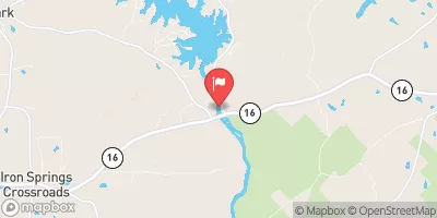
Located in Monroe, Georgia, the Tobesofkee Creek Watershed #41 is a flood risk reduction structure designed by SCS and completed in 1963.
°F
°F
mph
Wind
%
Humidity
Summary
This earth dam stands at a height of 47 feet and spans a length of 620 feet, with a storage capacity of 2,274 acre-feet. The primary purpose of this dam is to mitigate flood risks along the Yellow Creek, serving as a vital infrastructure for the local community in Smarr.
With a low hazard potential and moderate risk assessment rating, the Tobesofkee Creek Watershed #41 has not been state regulated but undergoes regular inspections every five years. Despite being uncontrolled, the spillway and outlet gates ensure efficient water management within the watershed. The surrounding area benefits from the dam's flood protection measures, demonstrating the importance of sustainable water resource management in the region.
Year Completed |
1963 |
Dam Length |
620 |
Dam Height |
47 |
River Or Stream |
YELLOW CREEK |
Primary Dam Type |
Earth |
Surface Area |
21 |
Drainage Area |
5000 |
Nid Storage |
2274 |
Outlet Gates |
Uncontrolled |
Hazard Potential |
Low |
Foundations |
Unlisted/Unknown |
Nid Height |
47 |
Seasonal Comparison
Weather Forecast
Nearby Streamflow Levels
 Tobesofkee Creek Near Macon
|
7cfs |
 Falling Creek Near Juliette
|
14cfs |
 Flint River Near Culloden
|
699cfs |
 Ocmulgee River At Macon
|
1570cfs |
 Ocmulgee River Near Jackson
|
552cfs |
 Shoal Creek At Shoal Creek Rd
|
19cfs |
Dam Data Reference
Condition Assessment
SatisfactoryNo existing or potential dam safety deficiencies are recognized. Acceptable performance is expected under all loading conditions (static, hydrologic, seismic) in accordance with the minimum applicable state or federal regulatory criteria or tolerable risk guidelines.
Fair
No existing dam safety deficiencies are recognized for normal operating conditions. Rare or extreme hydrologic and/or seismic events may result in a dam safety deficiency. Risk may be in the range to take further action. Note: Rare or extreme event is defined by the regulatory agency based on their minimum
Poor A dam safety deficiency is recognized for normal operating conditions which may realistically occur. Remedial action is necessary. POOR may also be used when uncertainties exist as to critical analysis parameters which identify a potential dam safety deficiency. Investigations and studies are necessary.
Unsatisfactory
A dam safety deficiency is recognized that requires immediate or emergency remedial action for problem resolution.
Not Rated
The dam has not been inspected, is not under state or federal jurisdiction, or has been inspected but, for whatever reason, has not been rated.
Not Available
Dams for which the condition assessment is restricted to approved government users.
Hazard Potential Classification
HighDams assigned the high hazard potential classification are those where failure or mis-operation will probably cause loss of human life.
Significant
Dams assigned the significant hazard potential classification are those dams where failure or mis-operation results in no probable loss of human life but can cause economic loss, environment damage, disruption of lifeline facilities, or impact other concerns. Significant hazard potential classification dams are often located in predominantly rural or agricultural areas but could be in areas with population and significant infrastructure.
Low
Dams assigned the low hazard potential classification are those where failure or mis-operation results in no probable loss of human life and low economic and/or environmental losses. Losses are principally limited to the owner's property.
Undetermined
Dams for which a downstream hazard potential has not been designated or is not provided.
Not Available
Dams for which the downstream hazard potential is restricted to approved government users.
 Tobesofkee Creek Watershed #41