
Crouch Lake Dam # 1 Reservoir Report
Last Updated: December 5, 2025
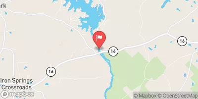
Crouch Lake Dam # 1, located in Griffin, Georgia, was completed in 1965 and serves as a vital recreation spot in Spalding County.
°F
°F
mph
Wind
%
Humidity
Summary
Designed by the Soil Conservation Service (SCS), this earth dam stands at a height of 28 feet, with a hydraulic height of 23 feet and a length of 600 feet. With a maximum storage capacity of 117 acre-feet and a normal storage of 72 acre-feet, the dam covers a surface area of 8 acres.
Although the dam is classified as having a low hazard potential, it is categorized as having a moderate risk assessment. The last inspection conducted on the dam was in October 2012, with an inspection frequency of 5 years. Despite its uncontrolled spillway type and outlet gates, Crouch Lake Dam # 1 continues to provide a safe and enjoyable environment for water resource and climate enthusiasts, offering recreational activities such as fishing and boating.
Year Completed |
1965 |
Dam Length |
600 |
Dam Height |
28 |
River Or Stream |
UNKNOWN |
Primary Dam Type |
Earth |
Surface Area |
8 |
Hydraulic Height |
23 |
Nid Storage |
117 |
Outlet Gates |
Uncontrolled |
Hazard Potential |
Low |
Foundations |
Unlisted/Unknown |
Nid Height |
28 |
Seasonal Comparison
Weather Forecast
Nearby Streamflow Levels
 Shoal Creek At Shoal Creek Rd
|
17cfs |
 Flint River Near Griffin
|
341cfs |
 Flint River Near Lovejoy
|
95cfs |
 Pates Creek At Buster Lewis Rd Near Flippen
|
5cfs |
 Line Creek Near Senoia
|
24cfs |
 Ocmulgee River Near Jackson
|
1600cfs |
Dam Data Reference
Condition Assessment
SatisfactoryNo existing or potential dam safety deficiencies are recognized. Acceptable performance is expected under all loading conditions (static, hydrologic, seismic) in accordance with the minimum applicable state or federal regulatory criteria or tolerable risk guidelines.
Fair
No existing dam safety deficiencies are recognized for normal operating conditions. Rare or extreme hydrologic and/or seismic events may result in a dam safety deficiency. Risk may be in the range to take further action. Note: Rare or extreme event is defined by the regulatory agency based on their minimum
Poor A dam safety deficiency is recognized for normal operating conditions which may realistically occur. Remedial action is necessary. POOR may also be used when uncertainties exist as to critical analysis parameters which identify a potential dam safety deficiency. Investigations and studies are necessary.
Unsatisfactory
A dam safety deficiency is recognized that requires immediate or emergency remedial action for problem resolution.
Not Rated
The dam has not been inspected, is not under state or federal jurisdiction, or has been inspected but, for whatever reason, has not been rated.
Not Available
Dams for which the condition assessment is restricted to approved government users.
Hazard Potential Classification
HighDams assigned the high hazard potential classification are those where failure or mis-operation will probably cause loss of human life.
Significant
Dams assigned the significant hazard potential classification are those dams where failure or mis-operation results in no probable loss of human life but can cause economic loss, environment damage, disruption of lifeline facilities, or impact other concerns. Significant hazard potential classification dams are often located in predominantly rural or agricultural areas but could be in areas with population and significant infrastructure.
Low
Dams assigned the low hazard potential classification are those where failure or mis-operation results in no probable loss of human life and low economic and/or environmental losses. Losses are principally limited to the owner's property.
Undetermined
Dams for which a downstream hazard potential has not been designated or is not provided.
Not Available
Dams for which the downstream hazard potential is restricted to approved government users.
 Crouch Lake Dam # 1
 Raymond Head Park
 Wyomia Tyus Olympic Park
 Warren Holder Park
 High Falls State Park
 Hampton City Park