


Asb Pond Dam Reservoir Report
Last Updated: April 26, 2026
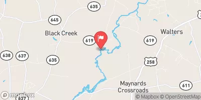
Nearby: B - 2 Pond Dam B - 1 Pond Dam
°F
°F
mph
Wind
%
Humidity
Located in Franklin, Virginia, the Asb Pond Dam, also known as the Aerated Stabilization Basin or Union Camp Holding Pond, is a privately owned structure regulated by the Department of Conservation and Recreation.
Summary
This earth dam stands at a height of 16.7 feet and has a normal storage capacity of 691.9 acre-feet, with a total storage of 1102.6 acre-feet. The dam's purpose is categorized as 'Other', serving a critical role in managing water resources for the surrounding area.
With a high hazard potential and fair condition assessment, the Asb Pond Dam requires regular inspections to ensure its structural integrity and the safety of the community downstream. The last inspection in January 2021 revealed that the dam meets regulatory standards but may benefit from further risk management measures. With its proximity to the Blackwater River and its offline position, the dam plays a crucial role in flood control and water management for the region.
Water resource and climate enthusiasts will be intrigued by the Asb Pond Dam's significance in the local ecosystem, its impact on water storage and flood prevention, and the ongoing efforts to maintain its safety and functionality. As a vital piece of infrastructure in Isle of Wight County, Virginia, this dam represents a key component in the region's water resource management strategy and highlights the importance of balancing human needs with environmental considerations in dam operations.
Regional Streamflow Levels
15-Day Long Term Forecast
Dam Length |
7785 |
Dam Height |
16.7 |
River Or Stream |
Blackwater River offline - VAHU6 CU70 - Blackwater River - Union Camp Holding Pondond VAHU6 CU70 |
Primary Dam Type |
Earth |
Surface Area |
101.3 |
Drainage Area |
0.2 |
Nid Storage |
1102.6 |
Hazard Potential |
High |
Nid Height |
17 |
Seasonal Comparison
5-Day Hourly Forecast Detail
Dam Data Reference
Condition Assessment
SatisfactoryNo existing or potential dam safety deficiencies are recognized. Acceptable performance is expected under all loading conditions (static, hydrologic, seismic) in accordance with the minimum applicable state or federal regulatory criteria or tolerable risk guidelines.
Fair
No existing dam safety deficiencies are recognized for normal operating conditions. Rare or extreme hydrologic and/or seismic events may result in a dam safety deficiency. Risk may be in the range to take further action. Note: Rare or extreme event is defined by the regulatory agency based on their minimum
Poor A dam safety deficiency is recognized for normal operating conditions which may realistically occur. Remedial action is necessary. POOR may also be used when uncertainties exist as to critical analysis parameters which identify a potential dam safety deficiency. Investigations and studies are necessary.
Unsatisfactory
A dam safety deficiency is recognized that requires immediate or emergency remedial action for problem resolution.
Not Rated
The dam has not been inspected, is not under state or federal jurisdiction, or has been inspected but, for whatever reason, has not been rated.
Not Available
Dams for which the condition assessment is restricted to approved government users.
Hazard Potential Classification
HighDams assigned the high hazard potential classification are those where failure or mis-operation will probably cause loss of human life.
Significant
Dams assigned the significant hazard potential classification are those dams where failure or mis-operation results in no probable loss of human life but can cause economic loss, environment damage, disruption of lifeline facilities, or impact other concerns. Significant hazard potential classification dams are often located in predominantly rural or agricultural areas but could be in areas with population and significant infrastructure.
Low
Dams assigned the low hazard potential classification are those where failure or mis-operation results in no probable loss of human life and low economic and/or environmental losses. Losses are principally limited to the owner's property.
Undetermined
Dams for which a downstream hazard potential has not been designated or is not provided.
Not Available
Dams for which the downstream hazard potential is restricted to approved government users.