


Ashland Oil Refinery Lake Dam Reservoir Report
Last Updated: April 27, 2026
Nearby: Bonita Lake Donaho Lake Dam
°F
°F
mph
Wind
%
Humidity
Located in Catlettsburg, Kentucky, the Ashland Oil Refinery Lake Dam is a privately owned structure regulated by the Kentucky Division of Water.
Summary
Built in 1959, this earth dam stands at a height of 42 feet and spans a length of 430 feet, with a primary purpose categorized as "Other." The dam has a storage capacity of 179 acre-feet, with a normal storage level of 128.2 acre-feet and a surface area of 7.4 acres.
The Ashland Oil Refinery Lake Dam poses a significant hazard potential and has a satisfactory condition assessment as of June 2018. With an inspection frequency of every three years, the dam's spillway type is uncontrolled, with a width of 10 feet. The risk assessment for this dam is categorized as moderate, with no emergency action plan currently in place. The structure is situated on Prichard Branch, with a drainage area of 0.18 square miles and falls under the jurisdiction of the Louisville District of the U.S. Army Corps of Engineers.
Overall, the Ashland Oil Refinery Lake Dam serves as a critical water resource infrastructure in Boyd County, Kentucky. With its historical significance and vital role in water management, this dam continues to be monitored and regulated to ensure the safety and sustainability of the surrounding area. Enthusiasts of water resources and climate will find this structure to be an intriguing example of human-made interventions in natural ecosystems.
Regional Streamflow Levels
 Ohio River At Ironton
|
58800cfs |
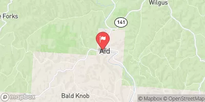 Symmes Creek At Aid Oh
|
66cfs |
 Little Sandy River At Grayson
|
66cfs |
 Tygarts Creek Near Greenup
|
29cfs |
 Ohio River At Greenup Dam Near Greenup
|
51800cfs |
 East Fork Twelvepole Creek Near Dunlow
|
8cfs |
15-Day Long Term Forecast
Year Completed |
1959 |
Dam Length |
430 |
Dam Height |
42 |
River Or Stream |
PRICHARD BRANCH |
Primary Dam Type |
Earth |
Surface Area |
7.4 |
Drainage Area |
0.18 |
Nid Storage |
179 |
Hazard Potential |
Significant |
Nid Height |
42 |
Seasonal Comparison
5-Day Hourly Forecast Detail
Dam Data Reference
Condition Assessment
SatisfactoryNo existing or potential dam safety deficiencies are recognized. Acceptable performance is expected under all loading conditions (static, hydrologic, seismic) in accordance with the minimum applicable state or federal regulatory criteria or tolerable risk guidelines.
Fair
No existing dam safety deficiencies are recognized for normal operating conditions. Rare or extreme hydrologic and/or seismic events may result in a dam safety deficiency. Risk may be in the range to take further action. Note: Rare or extreme event is defined by the regulatory agency based on their minimum
Poor A dam safety deficiency is recognized for normal operating conditions which may realistically occur. Remedial action is necessary. POOR may also be used when uncertainties exist as to critical analysis parameters which identify a potential dam safety deficiency. Investigations and studies are necessary.
Unsatisfactory
A dam safety deficiency is recognized that requires immediate or emergency remedial action for problem resolution.
Not Rated
The dam has not been inspected, is not under state or federal jurisdiction, or has been inspected but, for whatever reason, has not been rated.
Not Available
Dams for which the condition assessment is restricted to approved government users.
Hazard Potential Classification
HighDams assigned the high hazard potential classification are those where failure or mis-operation will probably cause loss of human life.
Significant
Dams assigned the significant hazard potential classification are those dams where failure or mis-operation results in no probable loss of human life but can cause economic loss, environment damage, disruption of lifeline facilities, or impact other concerns. Significant hazard potential classification dams are often located in predominantly rural or agricultural areas but could be in areas with population and significant infrastructure.
Low
Dams assigned the low hazard potential classification are those where failure or mis-operation results in no probable loss of human life and low economic and/or environmental losses. Losses are principally limited to the owner's property.
Undetermined
Dams for which a downstream hazard potential has not been designated or is not provided.
Not Available
Dams for which the downstream hazard potential is restricted to approved government users.
 Village South Point