


Flat Rock Creek Site 1 Reservoir Report
Last Updated: April 15, 2026
Nearby: Lake Lou Emma Dam Lee Creek
°F
°F
mph
Wind
%
Humidity
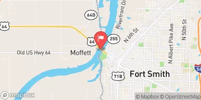
Flat Rock Creek Site 1, also known as Lake Cap Bedell, is a rockfill dam located in Crawford, Arkansas, designed by USDA NRCS and completed in 1982 for the primary purpose of flood risk reduction.
Summary
The dam stands at a height of 57 feet and spans 647 feet in length, providing a storage capacity of 509 acre-feet and a surface area of 11 acres. Situated on TOWN BRANCH, this structure is regulated by the Arkansas Natural Resources Commission and undergoes regular inspections to ensure its operational integrity.
With a hazard potential rated as high and a moderate risk assessment score of 3, Flat Rock Creek Site 1 serves as a crucial infrastructure for mitigating flood risks in the area. The dam's uncontrolled spillway and outlet gates, along with its stone core construction, contribute to its flood risk reduction capabilities. While the dam's condition assessment is currently not rated, its compliance with state regulations and inspection frequency ensure that it continues to fulfill its purpose effectively. For water resource and climate enthusiasts, this site offers a fascinating example of engineered resilience in managing water flow and mitigating flood hazards in the region.
Regional Streamflow Levels
 Arkansas River At Ft. Smith
|
30500cfs |
 Lee Creek Near Short
|
255cfs |
 Lee Creek At Short
|
116cfs |
 Little Lee Creek Near Short
|
63cfs |
 James Fork Near Hackett
|
60cfs |
 Mulberry River Near Mulberry. Ar
|
374cfs |
15-Day Long Term Forecast
Year Completed |
1982 |
Dam Length |
647 |
Dam Height |
57 |
River Or Stream |
TOWN BRANCH |
Primary Dam Type |
Rockfill |
Surface Area |
11 |
Drainage Area |
0.4 |
Nid Storage |
509 |
Outlet Gates |
Uncontrolled |
Hazard Potential |
High |
Nid Height |
57 |
Seasonal Comparison
5-Day Hourly Forecast Detail
Dam Data Reference
Condition Assessment
SatisfactoryNo existing or potential dam safety deficiencies are recognized. Acceptable performance is expected under all loading conditions (static, hydrologic, seismic) in accordance with the minimum applicable state or federal regulatory criteria or tolerable risk guidelines.
Fair
No existing dam safety deficiencies are recognized for normal operating conditions. Rare or extreme hydrologic and/or seismic events may result in a dam safety deficiency. Risk may be in the range to take further action. Note: Rare or extreme event is defined by the regulatory agency based on their minimum
Poor A dam safety deficiency is recognized for normal operating conditions which may realistically occur. Remedial action is necessary. POOR may also be used when uncertainties exist as to critical analysis parameters which identify a potential dam safety deficiency. Investigations and studies are necessary.
Unsatisfactory
A dam safety deficiency is recognized that requires immediate or emergency remedial action for problem resolution.
Not Rated
The dam has not been inspected, is not under state or federal jurisdiction, or has been inspected but, for whatever reason, has not been rated.
Not Available
Dams for which the condition assessment is restricted to approved government users.
Hazard Potential Classification
HighDams assigned the high hazard potential classification are those where failure or mis-operation will probably cause loss of human life.
Significant
Dams assigned the significant hazard potential classification are those dams where failure or mis-operation results in no probable loss of human life but can cause economic loss, environment damage, disruption of lifeline facilities, or impact other concerns. Significant hazard potential classification dams are often located in predominantly rural or agricultural areas but could be in areas with population and significant infrastructure.
Low
Dams assigned the low hazard potential classification are those where failure or mis-operation results in no probable loss of human life and low economic and/or environmental losses. Losses are principally limited to the owner's property.
Undetermined
Dams for which a downstream hazard potential has not been designated or is not provided.
Not Available
Dams for which the downstream hazard potential is restricted to approved government users.
Area Campgrounds
| Location | Reservations | Toilets |
|---|---|---|
 Lee Creek Public Use Area
|
||
 Fort Smith Alma RV Park
|
||
 Fort Chaffee RV Military
|
 Lee Creek At Lee Creek Reservoir Near Van Buren
 North Water Street 2885, Van Buren
 Carol Ann Cross Pond
 Frog Bayou
 Wells Lake