Foss Reservoir Near Foss Reservoir Report
Last Updated: February 4, 2026
Foss Reservoir is located near Foss, Oklahoma, and was constructed in the 1950s by the U.S.
°F
°F
mph
Wind
%
Humidity
15-Day Weather Outlook
Summary
Bureau of Reclamation for flood control and irrigation purposes. The reservoir has a storage capacity of 254,800 acre-feet of water and is fed by the Washita River. The hydrology of the reservoir is influenced by specific surface flows from the Washita River and snowpack providers during the winter months. The reservoir provides irrigation water for agriculture in the surrounding area and also offers recreational activities such as fishing, boating, and camping. The Foss Reservoir Dam, which is approximately 3,500 feet long and 117 feet high, was rehabilitated in the 1990s to ensure its safety and continued use.
Reservoir Details
| Gage Height, Ft 24hr Change | 0.0% |
| Percent of Normal | 100% |
| Minimum |
1,636.06 ft
2023-04-25 |
| Maximum |
1,642.48 ft
2025-06-19 |
| Average | 1,640 ft |
| Dam_Height | 142 |
| Hydraulic_Height | 128 |
| Drainage_Area | 1466 |
| Year_Completed | 1961 |
| Nid_Storage | 816888 |
| Structural_Height | 142 |
| Surface_Area | 13141 |
| Hazard_Potential | High |
| Outlet_Gates | Valve - 1 |
| River_Or_Stream | WASHITA RIVER |
| Dam_Length | 18130 |
| Primary_Dam_Type | Earth |
| Nid_Height | 142 |
Seasonal Comparison
Precipitation, Total, In Levels
Reservoir Storage, Acre-Ft Levels
Gage Height, Ft Levels
Hourly Weather Forecast
Nearby Streamflow Levels
 Washita River Near Foss
|
6cfs |
 Washita River Near Hammon
|
30cfs |
 Washita River Near Clinton
|
33cfs |
 Washita River Near Cheyenne
|
12cfs |
 North Fork Red River Near Carter
|
51cfs |
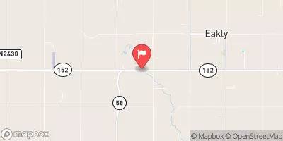 Cobb Creek Near Eakly
|
21cfs |
Dam Data Reference
Condition Assessment
SatisfactoryNo existing or potential dam safety deficiencies are recognized. Acceptable performance is expected under all loading conditions (static, hydrologic, seismic) in accordance with the minimum applicable state or federal regulatory criteria or tolerable risk guidelines.
Fair
No existing dam safety deficiencies are recognized for normal operating conditions. Rare or extreme hydrologic and/or seismic events may result in a dam safety deficiency. Risk may be in the range to take further action. Note: Rare or extreme event is defined by the regulatory agency based on their minimum
Poor A dam safety deficiency is recognized for normal operating conditions which may realistically occur. Remedial action is necessary. POOR may also be used when uncertainties exist as to critical analysis parameters which identify a potential dam safety deficiency. Investigations and studies are necessary.
Unsatisfactory
A dam safety deficiency is recognized that requires immediate or emergency remedial action for problem resolution.
Not Rated
The dam has not been inspected, is not under state or federal jurisdiction, or has been inspected but, for whatever reason, has not been rated.
Not Available
Dams for which the condition assessment is restricted to approved government users.
Hazard Potential Classification
HighDams assigned the high hazard potential classification are those where failure or mis-operation will probably cause loss of human life.
Significant
Dams assigned the significant hazard potential classification are those dams where failure or mis-operation results in no probable loss of human life but can cause economic loss, environment damage, disruption of lifeline facilities, or impact other concerns. Significant hazard potential classification dams are often located in predominantly rural or agricultural areas but could be in areas with population and significant infrastructure.
Low
Dams assigned the low hazard potential classification are those where failure or mis-operation results in no probable loss of human life and low economic and/or environmental losses. Losses are principally limited to the owner's property.
Undetermined
Dams for which a downstream hazard potential has not been designated or is not provided.
Not Available
Dams for which the downstream hazard potential is restricted to approved government users.

 Foss
Foss
 Foss Reservoir Near Foss