
Gifford-Hill Lake Dam Reservoir Report
Last Updated: April 1, 2026
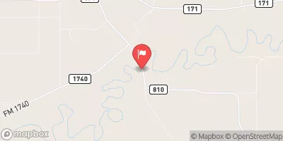
Gifford-Hill Lake Dam, located in Clay County, Texas, was completed in 1971 and stands at a height of 19 feet.
Summary
The dam is primarily used for purposes other than flood control or water supply, with a storage capacity of 251 acre-feet. Owned by a private entity, the dam is not regulated by the state and is inspected regularly to ensure its structural integrity.
This earth dam, with a buttress core type, sits on the off channel of Wichita River and does not have a spillway. Despite its high hazard potential, the dam's condition has not been rated, and there is no emergency action plan in place. The risk assessment for Gifford-Hill Lake Dam classifies it as high risk, emphasizing the importance of implementing proper risk management measures to mitigate any potential hazards.
For water resource and climate enthusiasts, Gifford-Hill Lake Dam serves as an interesting case study in dam infrastructure and risk assessment. With its unique design features and location, the dam presents a valuable opportunity to understand the complexities of managing water resources in a high-risk environment. Efforts to improve the dam's safety and emergency preparedness could provide valuable insights into sustainable water management practices in the face of changing climate conditions.
°F
°F
mph
Wind
%
Humidity
15-Day Weather Outlook
Year Completed |
1971 |
Dam Height |
19 |
River Or Stream |
OFF CH-WICHITA RIVER |
Primary Dam Type |
Earth |
Hydraulic Height |
19 |
Nid Storage |
251 |
Structural Height |
19 |
Outlet Gates |
None - 1 |
Hazard Potential |
Not Available |
Foundations |
Unlisted/Unknown |
Nid Height |
19 |
Seasonal Comparison
5-Day Hourly Forecast Detail
Nearby Streamflow Levels
 Wichita Rv Nr Charlie
|
1850cfs |
 Red Rv Nr Burkburnett
|
28cfs |
 Holliday Ck At Wichita Falls
|
66cfs |
 Wichita Rv At Wichita Falls
|
33cfs |
 Deep Red Creek Near Randlett
|
0cfs |
 Little Wichita Rv Abv Henrietta
|
21cfs |
Dam Data Reference
Condition Assessment
SatisfactoryNo existing or potential dam safety deficiencies are recognized. Acceptable performance is expected under all loading conditions (static, hydrologic, seismic) in accordance with the minimum applicable state or federal regulatory criteria or tolerable risk guidelines.
Fair
No existing dam safety deficiencies are recognized for normal operating conditions. Rare or extreme hydrologic and/or seismic events may result in a dam safety deficiency. Risk may be in the range to take further action. Note: Rare or extreme event is defined by the regulatory agency based on their minimum
Poor A dam safety deficiency is recognized for normal operating conditions which may realistically occur. Remedial action is necessary. POOR may also be used when uncertainties exist as to critical analysis parameters which identify a potential dam safety deficiency. Investigations and studies are necessary.
Unsatisfactory
A dam safety deficiency is recognized that requires immediate or emergency remedial action for problem resolution.
Not Rated
The dam has not been inspected, is not under state or federal jurisdiction, or has been inspected but, for whatever reason, has not been rated.
Not Available
Dams for which the condition assessment is restricted to approved government users.
Hazard Potential Classification
HighDams assigned the high hazard potential classification are those where failure or mis-operation will probably cause loss of human life.
Significant
Dams assigned the significant hazard potential classification are those dams where failure or mis-operation results in no probable loss of human life but can cause economic loss, environment damage, disruption of lifeline facilities, or impact other concerns. Significant hazard potential classification dams are often located in predominantly rural or agricultural areas but could be in areas with population and significant infrastructure.
Low
Dams assigned the low hazard potential classification are those where failure or mis-operation results in no probable loss of human life and low economic and/or environmental losses. Losses are principally limited to the owner's property.
Undetermined
Dams for which a downstream hazard potential has not been designated or is not provided.
Not Available
Dams for which the downstream hazard potential is restricted to approved government users.
 Gifford-Hill Lake Dam