


Gfs Dam Reservoir Report
Last Updated: April 15, 2026
Nearby: Dam No 6 North Club Lake Dam
°F
°F
mph
Wind
%
Humidity
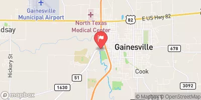
Gfs Dam, located in Gainesville, Texas, was completed in 1994 and serves as a critical infrastructure for flood risk reduction along the TR-Pecan Creek.
Summary
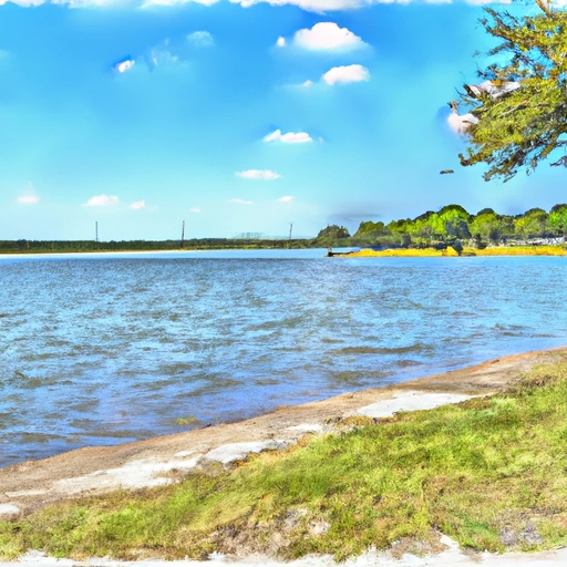
With a dam height of 8 feet and a length of 930 feet, this earth dam is designed to withstand high discharge levels, with a spillway width of 105 feet to manage water flow during peak periods. The dam has a normal storage capacity of 6 acre-feet and a maximum storage capacity of 53 acre-feet, covering a surface area of 13.3 acres.
Managed by a private owner, Gfs Dam is regulated by the Texas Commission on Environmental Quality (TCEQ) and undergoes regular inspections to ensure its structural integrity. The dam's condition assessment in February 2018 rated it as "fair," with a moderate risk level of 3. While the hazard potential is not available, the dam is equipped with two uncontrolled outlet gates to manage water levels effectively. The risk management measures and emergency action plan for Gfs Dam are not specified in the data, indicating potential areas for improvement in emergency preparedness and response.
Overall, Gfs Dam plays a crucial role in mitigating flood risks in the region and protecting the surrounding community from potential water-related disasters. Its strategic location and design features make it an essential component of the water resource infrastructure in Cooke County, Texas. Climate and water resource enthusiasts can appreciate the engineering and regulatory aspects of Gfs Dam, as well as the ongoing efforts to ensure its safety and effectiveness in flood risk management.
Regional Streamflow Levels
15-Day Long Term Forecast
Year Completed |
1994 |
Dam Length |
930 |
Dam Height |
8 |
River Or Stream |
TR-PECAN CREEK |
Primary Dam Type |
Earth |
Surface Area |
13.3 |
Hydraulic Height |
8 |
Drainage Area |
0.2 |
Nid Storage |
53 |
Structural Height |
8 |
Outlet Gates |
Uncontrolled - 2 |
Hazard Potential |
Not Available |
Foundations |
Unlisted/Unknown |
Nid Height |
8 |
Seasonal Comparison
5-Day Hourly Forecast Detail
Dam Data Reference
Condition Assessment
SatisfactoryNo existing or potential dam safety deficiencies are recognized. Acceptable performance is expected under all loading conditions (static, hydrologic, seismic) in accordance with the minimum applicable state or federal regulatory criteria or tolerable risk guidelines.
Fair
No existing dam safety deficiencies are recognized for normal operating conditions. Rare or extreme hydrologic and/or seismic events may result in a dam safety deficiency. Risk may be in the range to take further action. Note: Rare or extreme event is defined by the regulatory agency based on their minimum
Poor A dam safety deficiency is recognized for normal operating conditions which may realistically occur. Remedial action is necessary. POOR may also be used when uncertainties exist as to critical analysis parameters which identify a potential dam safety deficiency. Investigations and studies are necessary.
Unsatisfactory
A dam safety deficiency is recognized that requires immediate or emergency remedial action for problem resolution.
Not Rated
The dam has not been inspected, is not under state or federal jurisdiction, or has been inspected but, for whatever reason, has not been rated.
Not Available
Dams for which the condition assessment is restricted to approved government users.
Hazard Potential Classification
HighDams assigned the high hazard potential classification are those where failure or mis-operation will probably cause loss of human life.
Significant
Dams assigned the significant hazard potential classification are those dams where failure or mis-operation results in no probable loss of human life but can cause economic loss, environment damage, disruption of lifeline facilities, or impact other concerns. Significant hazard potential classification dams are often located in predominantly rural or agricultural areas but could be in areas with population and significant infrastructure.
Low
Dams assigned the low hazard potential classification are those where failure or mis-operation results in no probable loss of human life and low economic and/or environmental losses. Losses are principally limited to the owner's property.
Undetermined
Dams for which a downstream hazard potential has not been designated or is not provided.
Not Available
Dams for which the downstream hazard potential is restricted to approved government users.
 Moss Lk Nr Gainesville