


Amwell #2 Dam Reservoir Report
Last Updated: May 2, 2026
Nearby: Amwell No. 1 Dam Amwell No. 3 Dam
°F
°F
mph
Wind
%
Humidity
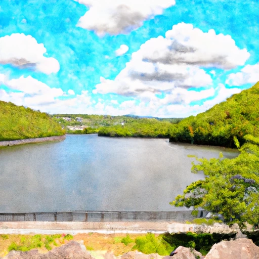
Amwell #2 Dam, located in West Amwell Township, Hunterdon County, New Jersey, stands as a picturesque earth dam along the Alexanken Creek-TR, with a primary purpose of recreation.
Summary
This privately owned dam, with a height of 19.2 feet and a length of 285 feet, offers a serene surface area of 12 acres and a drainage area of 0.9 square miles. Despite its significant hazard potential, the dam is in satisfactory condition, as assessed in November 2020, with a regular inspection frequency of every two years.
Managed by the New Jersey Department of Environmental Protection (NJDEP), Amwell #2 Dam serves as a vital recreational spot in the region, providing 69 acre-feet of storage for water activities. The dam's maximum discharge capacity of 223 cubic feet per second ensures the safety of downstream areas in case of emergencies. With a notable spillway width and a solid foundation, this gravity dam plays a crucial role in flood control and water resource management in the area.
As climate change continues to affect water resources and infrastructure, the maintenance and upkeep of dams like Amwell #2 Dam become increasingly important. With proper regulatory oversight and adherence to inspection protocols, this dam stands as a symbol of resilience and preparedness in the face of evolving environmental challenges.
Regional Streamflow Levels

15-Day Long Term Forecast
Dam Length |
285 |
Dam Height |
19.2 |
River Or Stream |
Alexanken Creek-TR |
Primary Dam Type |
Earth |
Surface Area |
12 |
Drainage Area |
0.9 |
Nid Storage |
69 |
Hazard Potential |
Significant |
Nid Height |
19 |
Seasonal Comparison
5-Day Hourly Forecast Detail
Dam Data Reference
Condition Assessment
SatisfactoryNo existing or potential dam safety deficiencies are recognized. Acceptable performance is expected under all loading conditions (static, hydrologic, seismic) in accordance with the minimum applicable state or federal regulatory criteria or tolerable risk guidelines.
Fair
No existing dam safety deficiencies are recognized for normal operating conditions. Rare or extreme hydrologic and/or seismic events may result in a dam safety deficiency. Risk may be in the range to take further action. Note: Rare or extreme event is defined by the regulatory agency based on their minimum
Poor A dam safety deficiency is recognized for normal operating conditions which may realistically occur. Remedial action is necessary. POOR may also be used when uncertainties exist as to critical analysis parameters which identify a potential dam safety deficiency. Investigations and studies are necessary.
Unsatisfactory
A dam safety deficiency is recognized that requires immediate or emergency remedial action for problem resolution.
Not Rated
The dam has not been inspected, is not under state or federal jurisdiction, or has been inspected but, for whatever reason, has not been rated.
Not Available
Dams for which the condition assessment is restricted to approved government users.
Hazard Potential Classification
HighDams assigned the high hazard potential classification are those where failure or mis-operation will probably cause loss of human life.
Significant
Dams assigned the significant hazard potential classification are those dams where failure or mis-operation results in no probable loss of human life but can cause economic loss, environment damage, disruption of lifeline facilities, or impact other concerns. Significant hazard potential classification dams are often located in predominantly rural or agricultural areas but could be in areas with population and significant infrastructure.
Low
Dams assigned the low hazard potential classification are those where failure or mis-operation results in no probable loss of human life and low economic and/or environmental losses. Losses are principally limited to the owner's property.
Undetermined
Dams for which a downstream hazard potential has not been designated or is not provided.
Not Available
Dams for which the downstream hazard potential is restricted to approved government users.
Area Campgrounds
| Location | Reservations | Toilets |
|---|---|---|
 Bulls Island State Park
|
||
 Doe Run Camp Ground
|
||
 Deer Wood Camp Ground
|
||
 Tohickon Valley County Park
|
||
 Campfire Site
|
||
 Shagbark
|
Nearby Reservoirs
-
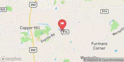
Amwell #2 Dam
-
Amwell No. 1 Dam
-
Amwell No. 3 Dam
-
Sullivan Pond Dam
-
Suez Water Lambertville #2 Dam
-
Stony Brook W.S. Site 11 (Amwell) Dam
-
 Lake Hopatcong At Landing Nj
-
 Mcmichael Creek Near Stroudsburg
-
 Delaware River Near Delaware Water Gap Pa
-
 Pocono Creek Near Stroudsburg
-
 Beltzville Lake Near Parryville
-
 Wanaque Reservoir At Wanaque Nj
 Lambertville in NJ