
Lauperouse Reservoir Report
Last Updated: January 12, 2026
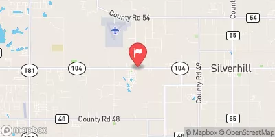
Lauperouse is a private fish and wildlife pond located in Daphne, Alabama, within Baldwin County.
°F
°F
mph
Wind
%
Humidity
Summary
Built in 1957 by the USDA NRCS, this Earth dam stands at 19 feet high and stretches 650 feet in length, with a storage capacity of 132 acre-feet. The primary purpose of Lauperouse is to provide habitat for fish and wildlife, as well as recreational opportunities for visitors.
The dam is situated on TR-Bay Minette Creek and is under the jurisdiction of the Mobile District of the US Army Corps of Engineers. With a low hazard potential and a moderate risk assessment rating, Lauperouse has not been rated for its condition assessment. The spillway, which is uncontrolled, has a width of 30 feet and a maximum discharge rate of 127 cubic feet per second. While the dam has not been inspected recently, it is important to note that it does not meet the guidelines for an Emergency Action Plan according to available data.
Overall, Lauperouse serves as an important water resource for the local community, providing not only ecological benefits but also recreational enjoyment. As climate change continues to impact water resources, it is essential to monitor and maintain structures like Lauperouse to ensure their safety and effectiveness in the face of changing environmental conditions.
Year Completed |
1957 |
Dam Length |
650 |
Dam Height |
19 |
River Or Stream |
TR-BAY MINETTE CR |
Primary Dam Type |
Earth |
Drainage Area |
0.14 |
Nid Storage |
132 |
Hazard Potential |
Low |
Nid Height |
19 |
Seasonal Comparison
Weather Forecast
Nearby Streamflow Levels


Dam Data Reference
Condition Assessment
SatisfactoryNo existing or potential dam safety deficiencies are recognized. Acceptable performance is expected under all loading conditions (static, hydrologic, seismic) in accordance with the minimum applicable state or federal regulatory criteria or tolerable risk guidelines.
Fair
No existing dam safety deficiencies are recognized for normal operating conditions. Rare or extreme hydrologic and/or seismic events may result in a dam safety deficiency. Risk may be in the range to take further action. Note: Rare or extreme event is defined by the regulatory agency based on their minimum
Poor A dam safety deficiency is recognized for normal operating conditions which may realistically occur. Remedial action is necessary. POOR may also be used when uncertainties exist as to critical analysis parameters which identify a potential dam safety deficiency. Investigations and studies are necessary.
Unsatisfactory
A dam safety deficiency is recognized that requires immediate or emergency remedial action for problem resolution.
Not Rated
The dam has not been inspected, is not under state or federal jurisdiction, or has been inspected but, for whatever reason, has not been rated.
Not Available
Dams for which the condition assessment is restricted to approved government users.
Hazard Potential Classification
HighDams assigned the high hazard potential classification are those where failure or mis-operation will probably cause loss of human life.
Significant
Dams assigned the significant hazard potential classification are those dams where failure or mis-operation results in no probable loss of human life but can cause economic loss, environment damage, disruption of lifeline facilities, or impact other concerns. Significant hazard potential classification dams are often located in predominantly rural or agricultural areas but could be in areas with population and significant infrastructure.
Low
Dams assigned the low hazard potential classification are those where failure or mis-operation results in no probable loss of human life and low economic and/or environmental losses. Losses are principally limited to the owner's property.
Undetermined
Dams for which a downstream hazard potential has not been designated or is not provided.
Not Available
Dams for which the downstream hazard potential is restricted to approved government users.
 Lauperouse
 Spanish Fort