
Lower Brushy Creek Ws Scs Site 24 Dam Reservoir Report
Last Updated: December 19, 2025
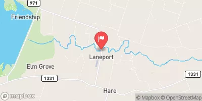
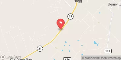
The Lower Brushy Creek WS SCS Site 24 Dam is a flood risk reduction structure located in Milam, Texas, designed by the USDA NRCS and completed in 1964.
°F
°F
mph
Wind
%
Humidity
Summary
The dam is primarily used for flood risk reduction but also serves purposes such as fire protection, stock, and small fish pond. It stands at a height of 37 feet with a length of 1800 feet, providing a storage capacity of 1307 acre-feet.
Managed by the TCEQ and regulated by the state of Texas, the dam is in fair condition as of the latest assessment in April 2021. Although the hazard potential is not available, the risk assessment is classified as high (2), indicating the importance of proper maintenance and monitoring. With no spillway and one outlet gate, the dam plays a crucial role in managing water resources in the region and protecting downstream communities along Schoolhouse Branch.
Overall, the Lower Brushy Creek WS SCS Site 24 Dam is a vital infrastructure for flood control in the area, reflecting the collaborative efforts of local government and federal agencies. With its strategic location and design, the dam serves as a key component in the water resource management system, highlighting the intersection of engineering, climate resilience, and environmental stewardship in safeguarding communities against natural disasters.
Dam Height |
37 |
Hydraulic Height |
37 |
Year Completed |
1964 |
Structural Height |
37 |
Nid Storage |
1307 |
Foundations |
Unlisted/Unknown |
Outlet Gates |
None - 1 |
River Or Stream |
SCHOOLHOUSE BRANCH |
Dam Length |
1800 |
Hazard Potential |
Not Available |
Primary Dam Type |
Earth |
Nid Height |
37 |
Seasonal Comparison
Weather Forecast
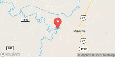
Nearby Streamflow Levels
 San Gabriel Rv At Laneport
|
8cfs |
 Little Rv Nr Rockdale
|
156cfs |
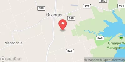 Willis Ck Nr Granger
|
0cfs |
 Middle Yegua Ck Nr Dime Box
|
0cfs |
 E Yegua Ck Nr Dime Box
|
0cfs |
 Little Rv At Cameron
|
159cfs |
Dam Data Reference
Condition Assessment
SatisfactoryNo existing or potential dam safety deficiencies are recognized. Acceptable performance is expected under all loading conditions (static, hydrologic, seismic) in accordance with the minimum applicable state or federal regulatory criteria or tolerable risk guidelines.
Fair
No existing dam safety deficiencies are recognized for normal operating conditions. Rare or extreme hydrologic and/or seismic events may result in a dam safety deficiency. Risk may be in the range to take further action. Note: Rare or extreme event is defined by the regulatory agency based on their minimum
Poor A dam safety deficiency is recognized for normal operating conditions which may realistically occur. Remedial action is necessary. POOR may also be used when uncertainties exist as to critical analysis parameters which identify a potential dam safety deficiency. Investigations and studies are necessary.
Unsatisfactory
A dam safety deficiency is recognized that requires immediate or emergency remedial action for problem resolution.
Not Rated
The dam has not been inspected, is not under state or federal jurisdiction, or has been inspected but, for whatever reason, has not been rated.
Not Available
Dams for which the condition assessment is restricted to approved government users.
Hazard Potential Classification
HighDams assigned the high hazard potential classification are those where failure or mis-operation will probably cause loss of human life.
Significant
Dams assigned the significant hazard potential classification are those dams where failure or mis-operation results in no probable loss of human life but can cause economic loss, environment damage, disruption of lifeline facilities, or impact other concerns. Significant hazard potential classification dams are often located in predominantly rural or agricultural areas but could be in areas with population and significant infrastructure.
Low
Dams assigned the low hazard potential classification are those where failure or mis-operation results in no probable loss of human life and low economic and/or environmental losses. Losses are principally limited to the owner's property.
Undetermined
Dams for which a downstream hazard potential has not been designated or is not provided.
Not Available
Dams for which the downstream hazard potential is restricted to approved government users.
 Lower Brushy Creek Ws Scs Site 24 Dam