
Don Good Number 3 Dam Reservoir Report
Last Updated: December 25, 2025
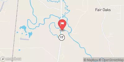
Don Good Number 3 Dam, located in Noxubee, Mississippi, is a privately owned earth dam designed by Stephen L.
°F
°F
mph
Wind
%
Humidity
Summary
Miller and completed in 2006 for the primary purpose of irrigation. With a height of 17.7 feet and a storage capacity of 306 acre-feet, this dam plays a crucial role in managing water resources in the region. The dam is regulated by the Mississippi Department of Environmental Quality and is inspected regularly to ensure its structural integrity.
Despite its low hazard potential, the dam has a moderate risk assessment due to the surrounding conditions. The dam features uncontrolled spillways and outlet gates, and its risk management measures are currently not specified. The risk assessment highlights the importance of proper maintenance and emergency preparedness for this essential water resource infrastructure. Overall, the Don Good Number 3 Dam serves as a vital component of water management in the area, contributing to agricultural irrigation and ensuring sustainable water usage for the community.
Year Completed |
2006 |
Dam Length |
3500 |
Dam Height |
17.7 |
River Or Stream |
UNT OF UNT OF BOGUE CHITTO CREEK |
Primary Dam Type |
Earth |
Surface Area |
26.9 |
Hydraulic Height |
16.2 |
Drainage Area |
0.04 |
Nid Storage |
306 |
Structural Height |
17.7 |
Outlet Gates |
Uncontrolled |
Hazard Potential |
Low |
Foundations |
Soil |
Nid Height |
18 |
Seasonal Comparison
Weather Forecast
Nearby Streamflow Levels
 Tombigbee River At Bevill L&D Nr Pickensville
|
2660cfs |
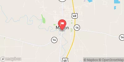 Noxubee River At Macon
|
127cfs |
 Noxubee River Nr Geiger
|
199cfs |
 Luxapallila Creek Nr Columbus
|
373cfs |
 Tombigbee River At Stennis Lock And Dam
|
1740cfs |
 Catalpa Creek At Mayhew
|
2940cfs |
Dam Data Reference
Condition Assessment
SatisfactoryNo existing or potential dam safety deficiencies are recognized. Acceptable performance is expected under all loading conditions (static, hydrologic, seismic) in accordance with the minimum applicable state or federal regulatory criteria or tolerable risk guidelines.
Fair
No existing dam safety deficiencies are recognized for normal operating conditions. Rare or extreme hydrologic and/or seismic events may result in a dam safety deficiency. Risk may be in the range to take further action. Note: Rare or extreme event is defined by the regulatory agency based on their minimum
Poor A dam safety deficiency is recognized for normal operating conditions which may realistically occur. Remedial action is necessary. POOR may also be used when uncertainties exist as to critical analysis parameters which identify a potential dam safety deficiency. Investigations and studies are necessary.
Unsatisfactory
A dam safety deficiency is recognized that requires immediate or emergency remedial action for problem resolution.
Not Rated
The dam has not been inspected, is not under state or federal jurisdiction, or has been inspected but, for whatever reason, has not been rated.
Not Available
Dams for which the condition assessment is restricted to approved government users.
Hazard Potential Classification
HighDams assigned the high hazard potential classification are those where failure or mis-operation will probably cause loss of human life.
Significant
Dams assigned the significant hazard potential classification are those dams where failure or mis-operation results in no probable loss of human life but can cause economic loss, environment damage, disruption of lifeline facilities, or impact other concerns. Significant hazard potential classification dams are often located in predominantly rural or agricultural areas but could be in areas with population and significant infrastructure.
Low
Dams assigned the low hazard potential classification are those where failure or mis-operation results in no probable loss of human life and low economic and/or environmental losses. Losses are principally limited to the owner's property.
Undetermined
Dams for which a downstream hazard potential has not been designated or is not provided.
Not Available
Dams for which the downstream hazard potential is restricted to approved government users.
 Don Good Number 3 Dam