
Lower Brushy Creek Ws Scs Site 21 Dam Reservoir Report
Last Updated: December 19, 2025
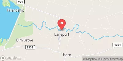
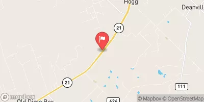
Lower Brushy Creek WS SCS Site 21 Dam, located in Williamson County, Texas, was completed in 1960 with a primary purpose of flood risk reduction.
°F
°F
mph
Wind
%
Humidity
Summary
Designed by USDA NRCS, this earth dam stands at a height of 19 feet and spans a length of 1200 feet along the Brushy Creek. The dam has a storage capacity of 548 acre-feet, with a normal storage level of 54 acre-feet.
This dam is regulated by the Texas Commission on Environmental Quality (TCEQ) and is inspected, permitted, and enforced by state agencies. The condition of the dam is assessed as fair, with a high risk level of 2. Although the hazard potential is not available, the dam is categorized as having a high risk due to its critical function in flood risk reduction. With no spillway and limited structural features, the dam serves as a vital component in managing water resources and protecting the surrounding areas from potential flooding events.
Owned by the local government, Lower Brushy Creek WS SCS Site 21 Dam plays a crucial role in fire protection, stock, and small fish ponds in addition to its core function of flood risk reduction. With its strategic location in Williamson County and its historical significance dating back to 1960, this dam stands as a testament to the importance of water resource management in the face of changing climate patterns and increasing risks of extreme weather events.
Year Completed |
1960 |
Dam Length |
1200 |
Dam Height |
19 |
River Or Stream |
TR-BRUSHY CREEK |
Primary Dam Type |
Earth |
Hydraulic Height |
19 |
Nid Storage |
548 |
Structural Height |
19 |
Outlet Gates |
None - 1 |
Hazard Potential |
Not Available |
Foundations |
Unlisted/Unknown |
Nid Height |
19 |
Seasonal Comparison
Weather Forecast
Nearby Streamflow Levels
Dam Data Reference
Condition Assessment
SatisfactoryNo existing or potential dam safety deficiencies are recognized. Acceptable performance is expected under all loading conditions (static, hydrologic, seismic) in accordance with the minimum applicable state or federal regulatory criteria or tolerable risk guidelines.
Fair
No existing dam safety deficiencies are recognized for normal operating conditions. Rare or extreme hydrologic and/or seismic events may result in a dam safety deficiency. Risk may be in the range to take further action. Note: Rare or extreme event is defined by the regulatory agency based on their minimum
Poor A dam safety deficiency is recognized for normal operating conditions which may realistically occur. Remedial action is necessary. POOR may also be used when uncertainties exist as to critical analysis parameters which identify a potential dam safety deficiency. Investigations and studies are necessary.
Unsatisfactory
A dam safety deficiency is recognized that requires immediate or emergency remedial action for problem resolution.
Not Rated
The dam has not been inspected, is not under state or federal jurisdiction, or has been inspected but, for whatever reason, has not been rated.
Not Available
Dams for which the condition assessment is restricted to approved government users.
Hazard Potential Classification
HighDams assigned the high hazard potential classification are those where failure or mis-operation will probably cause loss of human life.
Significant
Dams assigned the significant hazard potential classification are those dams where failure or mis-operation results in no probable loss of human life but can cause economic loss, environment damage, disruption of lifeline facilities, or impact other concerns. Significant hazard potential classification dams are often located in predominantly rural or agricultural areas but could be in areas with population and significant infrastructure.
Low
Dams assigned the low hazard potential classification are those where failure or mis-operation results in no probable loss of human life and low economic and/or environmental losses. Losses are principally limited to the owner's property.
Undetermined
Dams for which a downstream hazard potential has not been designated or is not provided.
Not Available
Dams for which the downstream hazard potential is restricted to approved government users.
 Lower Brushy Creek Ws Scs Site 21 Dam