
Summary
Completed in 1959, this dam serves primarily for irrigation purposes and is regulated by the Bureau of Reclamation. With a height of 208 feet and a storage capacity of 22,390 acre-feet, Anchor plays a crucial role in managing water resources in the region.
Managed by the Bureau of Reclamation, Anchor has a spillway width of 100 feet and a maximum discharge capacity of 13,500 cubic feet per second. The dam's hazard potential is classified as high, indicating the importance of regular inspections and risk management measures. Despite its age and condition assessment not being available, Anchor remains a key structure in the water infrastructure of Wyoming.
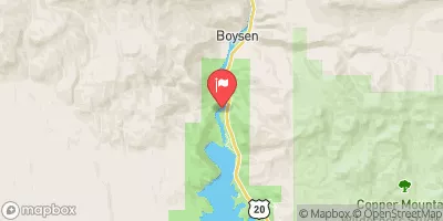
Located in a picturesque setting in Embar, Anchor's historical significance and engineering feat make it a fascinating site for water resource and climate enthusiasts. With its impressive design by Don M Forester and operational oversight by the Bureau of Reclamation, Anchor stands as a testament to the importance of water management in sustaining agricultural activities in the region.
Year Completed |
1959 |
Dam Length |
660 |
Dam Height |
208 |
River Or Stream |
SOUTH FORK OWL CREEK |
Primary Dam Type |
Concrete |
Surface Area |
437 |
Hydraulic Height |
196 |
Drainage Area |
131 |
Nid Storage |
22390 |
Structural Height |
208 |
Outlet Gates |
Valve - 2 |
Hazard Potential |
High |
Foundations |
Soil |
Nid Height |
208 |
Seasonal Comparison
Weather Forecast
Nearby Streamflow Levels
 Cottonwood C At High Island Rnch Nr Hamilton Dome
|
1cfs |
 Wind River Near Crowheart
|
1630cfs |
 Bull Lake Creek Near Lenore
|
831cfs |
 Greybull River At Meeteetse
|
338cfs |
 Wind River Above Red Creek
|
225cfs |
 Wind R Bl Boysen Res Wyo
|
819cfs |
Dam Data Reference
Condition Assessment
SatisfactoryNo existing or potential dam safety deficiencies are recognized. Acceptable performance is expected under all loading conditions (static, hydrologic, seismic) in accordance with the minimum applicable state or federal regulatory criteria or tolerable risk guidelines.
Fair
No existing dam safety deficiencies are recognized for normal operating conditions. Rare or extreme hydrologic and/or seismic events may result in a dam safety deficiency. Risk may be in the range to take further action. Note: Rare or extreme event is defined by the regulatory agency based on their minimum
Poor A dam safety deficiency is recognized for normal operating conditions which may realistically occur. Remedial action is necessary. POOR may also be used when uncertainties exist as to critical analysis parameters which identify a potential dam safety deficiency. Investigations and studies are necessary.
Unsatisfactory
A dam safety deficiency is recognized that requires immediate or emergency remedial action for problem resolution.
Not Rated
The dam has not been inspected, is not under state or federal jurisdiction, or has been inspected but, for whatever reason, has not been rated.
Not Available
Dams for which the condition assessment is restricted to approved government users.
Hazard Potential Classification
HighDams assigned the high hazard potential classification are those where failure or mis-operation will probably cause loss of human life.
Significant
Dams assigned the significant hazard potential classification are those dams where failure or mis-operation results in no probable loss of human life but can cause economic loss, environment damage, disruption of lifeline facilities, or impact other concerns. Significant hazard potential classification dams are often located in predominantly rural or agricultural areas but could be in areas with population and significant infrastructure.
Low
Dams assigned the low hazard potential classification are those where failure or mis-operation results in no probable loss of human life and low economic and/or environmental losses. Losses are principally limited to the owner's property.
Undetermined
Dams for which a downstream hazard potential has not been designated or is not provided.
Not Available
Dams for which the downstream hazard potential is restricted to approved government users.
 Anchor