


Telfair Pond Dam Reservoir Report
Last Updated: April 28, 2026
°F
°F
mph
Wind
%
Humidity
Telfair Pond Dam, located in Burke, Georgia, was completed in 1950 and serves as a recreational spot for water resource and climate enthusiasts.
Summary
The dam, primarily used for recreation, stands at a height of 16 feet with a hydraulic height of 15 feet. It spans 780 feet in length and has a storage capacity of 665 acre-feet, providing opportunities for activities such as fishing, boating, and wildlife observation on its 56-acre surface area.
Despite its low hazard potential and moderate risk assessment, Telfair Pond Dam has not been rated for its condition as of yet. The dam is inspected every five years, with the last inspection conducted in June 2014. While the dam is not federally owned or regulated, it is under state jurisdiction and is subject to state inspections to ensure its safety and functionality for recreational use in the Stony Bluff Environs near Beaverdam Creek.
With its earth dam type and uncontrolled spillway, Telfair Pond Dam offers a peaceful retreat for outdoor enthusiasts seeking to enjoy the natural beauty of Georgia's waterways. While its risk assessment indicates a moderate level of concern, the dam's ongoing inspections and maintenance efforts aim to ensure the safety of visitors and the surrounding environment for years to come.
Regional Streamflow Levels
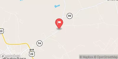 Brier Creek Near Waynesboro
|
85cfs |
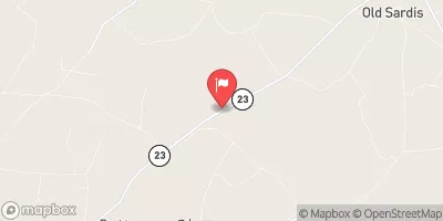 Beaverdam Creek Near Sardis
|
3cfs |
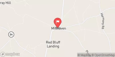 Brier Creek At Millhaven
|
116cfs |
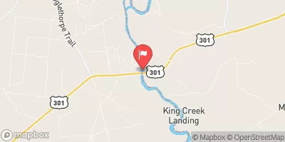 Savannah R At Burtons Ferry Br Nr Millhaven
|
4750cfs |
 Savannah River At Augusta
|
4390cfs |
 Spirit Creek At Us 1
|
9cfs |
15-Day Long Term Forecast
Year Completed |
1950 |
Dam Length |
780 |
Dam Height |
16 |
River Or Stream |
BEAVERDAM CREEK |
Primary Dam Type |
Earth |
Surface Area |
56 |
Hydraulic Height |
15 |
Nid Storage |
665 |
Structural Height |
15 |
Outlet Gates |
Uncontrolled |
Hazard Potential |
Low |
Foundations |
Unlisted/Unknown |
Nid Height |
16 |
Seasonal Comparison
5-Day Hourly Forecast Detail
Dam Data Reference
Condition Assessment
SatisfactoryNo existing or potential dam safety deficiencies are recognized. Acceptable performance is expected under all loading conditions (static, hydrologic, seismic) in accordance with the minimum applicable state or federal regulatory criteria or tolerable risk guidelines.
Fair
No existing dam safety deficiencies are recognized for normal operating conditions. Rare or extreme hydrologic and/or seismic events may result in a dam safety deficiency. Risk may be in the range to take further action. Note: Rare or extreme event is defined by the regulatory agency based on their minimum
Poor A dam safety deficiency is recognized for normal operating conditions which may realistically occur. Remedial action is necessary. POOR may also be used when uncertainties exist as to critical analysis parameters which identify a potential dam safety deficiency. Investigations and studies are necessary.
Unsatisfactory
A dam safety deficiency is recognized that requires immediate or emergency remedial action for problem resolution.
Not Rated
The dam has not been inspected, is not under state or federal jurisdiction, or has been inspected but, for whatever reason, has not been rated.
Not Available
Dams for which the condition assessment is restricted to approved government users.
Hazard Potential Classification
HighDams assigned the high hazard potential classification are those where failure or mis-operation will probably cause loss of human life.
Significant
Dams assigned the significant hazard potential classification are those dams where failure or mis-operation results in no probable loss of human life but can cause economic loss, environment damage, disruption of lifeline facilities, or impact other concerns. Significant hazard potential classification dams are often located in predominantly rural or agricultural areas but could be in areas with population and significant infrastructure.
Low
Dams assigned the low hazard potential classification are those where failure or mis-operation results in no probable loss of human life and low economic and/or environmental losses. Losses are principally limited to the owner's property.
Undetermined
Dams for which a downstream hazard potential has not been designated or is not provided.
Not Available
Dams for which the downstream hazard potential is restricted to approved government users.