
Wilson Pond Dam Reservoir Report
Nearby: Burns Pond Dam Lake Louise
Last Updated: December 29, 2025
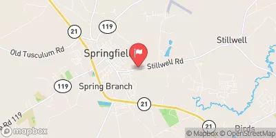
Wilson Pond Dam, located in Effingham, Georgia, was completed in 1936 by designer F.C.
°F
°F
mph
Wind
%
Humidity
Summary
Wilson and serves as a recreational water resource along the Devils Branch river. This private earth dam stands at a height of 14 feet and has a hydraulic height of 12 feet, with a length of 800 feet and a storage capacity of 292 acre-feet. Despite being unregulated by the state, the dam's hazard potential is categorized as low, with a moderate risk assessment rating.
The dam's primary purpose is for recreation, providing a surface area of 20 acres for water enthusiasts to enjoy. While the dam has not been inspected since 1988, it is noted to have a condition assessment of "Not Rated." With uncontrolled spillways and outlet gates, the dam presents a moderate risk level and has an inspection frequency of every 5 years. Despite its age, Wilson Pond Dam continues to be a beloved recreational spot for locals and visitors alike, showcasing the beauty and resilience of water resources in the region.
Year Completed |
1936 |
Dam Length |
800 |
Dam Height |
14 |
River Or Stream |
DEVILS BRANCH |
Primary Dam Type |
Earth |
Surface Area |
20 |
Hydraulic Height |
12 |
Drainage Area |
12500 |
Nid Storage |
292 |
Outlet Gates |
Uncontrolled |
Hazard Potential |
Low |
Foundations |
Unlisted/Unknown |
Nid Height |
14 |
Seasonal Comparison
Weather Forecast
Nearby Streamflow Levels
 Savannah River Near Clyo
|
5980cfs |
 Ebenezer Creek At Springfield
|
5cfs |
 Abercorn Cr (Water Intake) Nr Savannah
|
942cfs |
 Ogeechee River Near Eden
|
747cfs |
 Savannah River Near Port Wentworth
|
15900cfs |
 Black Creek Near Blitchton
|
11cfs |
Dam Data Reference
Condition Assessment
SatisfactoryNo existing or potential dam safety deficiencies are recognized. Acceptable performance is expected under all loading conditions (static, hydrologic, seismic) in accordance with the minimum applicable state or federal regulatory criteria or tolerable risk guidelines.
Fair
No existing dam safety deficiencies are recognized for normal operating conditions. Rare or extreme hydrologic and/or seismic events may result in a dam safety deficiency. Risk may be in the range to take further action. Note: Rare or extreme event is defined by the regulatory agency based on their minimum
Poor A dam safety deficiency is recognized for normal operating conditions which may realistically occur. Remedial action is necessary. POOR may also be used when uncertainties exist as to critical analysis parameters which identify a potential dam safety deficiency. Investigations and studies are necessary.
Unsatisfactory
A dam safety deficiency is recognized that requires immediate or emergency remedial action for problem resolution.
Not Rated
The dam has not been inspected, is not under state or federal jurisdiction, or has been inspected but, for whatever reason, has not been rated.
Not Available
Dams for which the condition assessment is restricted to approved government users.
Hazard Potential Classification
HighDams assigned the high hazard potential classification are those where failure or mis-operation will probably cause loss of human life.
Significant
Dams assigned the significant hazard potential classification are those dams where failure or mis-operation results in no probable loss of human life but can cause economic loss, environment damage, disruption of lifeline facilities, or impact other concerns. Significant hazard potential classification dams are often located in predominantly rural or agricultural areas but could be in areas with population and significant infrastructure.
Low
Dams assigned the low hazard potential classification are those where failure or mis-operation results in no probable loss of human life and low economic and/or environmental losses. Losses are principally limited to the owner's property.
Undetermined
Dams for which a downstream hazard potential has not been designated or is not provided.
Not Available
Dams for which the downstream hazard potential is restricted to approved government users.
 Wilson Pond Dam