
Banion John O No 10 Reservoir Report
Nearby: Oknoname 095004 Carter Lake
Last Updated: December 6, 2025
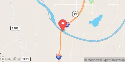
Banion John O No 10 is a privately owned earth dam located in Carter Lake, Oklahoma, designed by the USDA NRCS and completed in 1978 for flood risk reduction on Glasses Creek.
°F
°F
mph
Wind
%
Humidity
Summary
With a height of 38 feet and a storage capacity of 152 acre-feet, this dam plays a crucial role in mitigating potential flooding in the area. It is regulated by the Oklahoma Water Resources Board and undergoes regular inspections to ensure its structural integrity and safety.
The dam features a controlled spillway and a single valve outlet gate for water release when needed. Despite being rated as having a low hazard potential, it is classified as having a very high risk due to its location and the potential impact of a breach on downstream areas. The dam has not been modified since its completion, and its condition is currently not rated, highlighting the need for ongoing monitoring and maintenance to ensure its continued effectiveness in flood risk reduction.
Managed by the Natural Resources Conservation Service, Banion John O No 10 serves as a vital infrastructure for water resource management in Marshall County, Oklahoma. With its strategic design and purposeful construction, this dam stands as a testament to the importance of proactive measures in enhancing water security and climate resilience in the face of potential natural disasters.
Year Completed |
1978 |
Dam Length |
756 |
Dam Height |
38 |
River Or Stream |
GLASSES CREEK |
Primary Dam Type |
Earth |
Hydraulic Height |
35 |
Nid Storage |
152 |
Structural Height |
38 |
Outlet Gates |
Valve - 1 |
Hazard Potential |
Low |
Foundations |
Soil |
Nid Height |
38 |
Seasonal Comparison
Weather Forecast
Nearby Streamflow Levels
 Washita River Near Dickson
|
317cfs |
 Pennington Creek Near Reagan
|
7cfs |
 Blue River Near Connerville
|
54cfs |
 Red River At Denison Dam Nr Denison
|
44cfs |
 Rock Creek At Sulphur
|
8cfs |
 Red River Near Gainesville
|
386cfs |
Dam Data Reference
Condition Assessment
SatisfactoryNo existing or potential dam safety deficiencies are recognized. Acceptable performance is expected under all loading conditions (static, hydrologic, seismic) in accordance with the minimum applicable state or federal regulatory criteria or tolerable risk guidelines.
Fair
No existing dam safety deficiencies are recognized for normal operating conditions. Rare or extreme hydrologic and/or seismic events may result in a dam safety deficiency. Risk may be in the range to take further action. Note: Rare or extreme event is defined by the regulatory agency based on their minimum
Poor A dam safety deficiency is recognized for normal operating conditions which may realistically occur. Remedial action is necessary. POOR may also be used when uncertainties exist as to critical analysis parameters which identify a potential dam safety deficiency. Investigations and studies are necessary.
Unsatisfactory
A dam safety deficiency is recognized that requires immediate or emergency remedial action for problem resolution.
Not Rated
The dam has not been inspected, is not under state or federal jurisdiction, or has been inspected but, for whatever reason, has not been rated.
Not Available
Dams for which the condition assessment is restricted to approved government users.
Hazard Potential Classification
HighDams assigned the high hazard potential classification are those where failure or mis-operation will probably cause loss of human life.
Significant
Dams assigned the significant hazard potential classification are those dams where failure or mis-operation results in no probable loss of human life but can cause economic loss, environment damage, disruption of lifeline facilities, or impact other concerns. Significant hazard potential classification dams are often located in predominantly rural or agricultural areas but could be in areas with population and significant infrastructure.
Low
Dams assigned the low hazard potential classification are those where failure or mis-operation results in no probable loss of human life and low economic and/or environmental losses. Losses are principally limited to the owner's property.
Undetermined
Dams for which a downstream hazard potential has not been designated or is not provided.
Not Available
Dams for which the downstream hazard potential is restricted to approved government users.
 Banion John O No 10