
Bennetts Branch Slurry Dam Reservoir Report
Nearby: Powers Branch Stanley Teague Lake Dam
Last Updated: April 1, 2026
Bennetts Branch Slurry Dam, located in Gatliff, Kentucky, is a private structure primarily used for water supply purposes.
Summary
Standing at a height of 340 feet with a length of 1360 feet, this earth dam has a storage capacity of 2487 acre-feet. Despite being privately owned and not regulated by the state, this dam poses a high hazard potential due to its size and potential impact on the surrounding area in the event of a failure.
Managed by the Mine Safety and Health Administration, Bennetts Branch Slurry Dam has not undergone recent inspections, and its condition assessment is currently listed as "Not Available." With no emergency action plan in place and limited risk assessment information, there is a need for increased monitoring and preparedness measures to ensure the safety and integrity of this critical water resource infrastructure. As climate change continues to impact water resources and extreme weather events become more frequent, the importance of maintaining and securing dams like Bennetts Branch Slurry Dam becomes increasingly crucial for the surrounding community and the environment.
°F
°F
mph
Wind
%
Humidity
15-Day Weather Outlook
Dam Length |
1360 |
Dam Height |
340 |
Primary Dam Type |
Earth |
Nid Storage |
2487 |
Hazard Potential |
High |
Nid Height |
340 |
Seasonal Comparison
5-Day Hourly Forecast Detail
Nearby Streamflow Levels
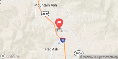 Clear Fork At Saxton
|
204cfs |
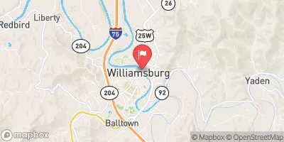 Cumberland River At Williamsburg
|
1210cfs |
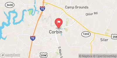 Lynn Camp Creek At Corbin
|
26cfs |
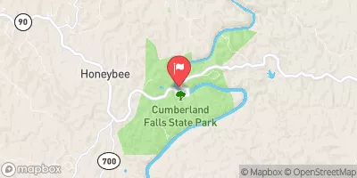 Cumberland River At Cumberland Falls
|
1460cfs |
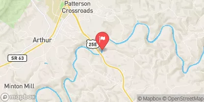 Powell River Near Arthur
|
529cfs |
 South Fork Cumberland River Near Stearns
|
195cfs |
Dam Data Reference
Condition Assessment
SatisfactoryNo existing or potential dam safety deficiencies are recognized. Acceptable performance is expected under all loading conditions (static, hydrologic, seismic) in accordance with the minimum applicable state or federal regulatory criteria or tolerable risk guidelines.
Fair
No existing dam safety deficiencies are recognized for normal operating conditions. Rare or extreme hydrologic and/or seismic events may result in a dam safety deficiency. Risk may be in the range to take further action. Note: Rare or extreme event is defined by the regulatory agency based on their minimum
Poor A dam safety deficiency is recognized for normal operating conditions which may realistically occur. Remedial action is necessary. POOR may also be used when uncertainties exist as to critical analysis parameters which identify a potential dam safety deficiency. Investigations and studies are necessary.
Unsatisfactory
A dam safety deficiency is recognized that requires immediate or emergency remedial action for problem resolution.
Not Rated
The dam has not been inspected, is not under state or federal jurisdiction, or has been inspected but, for whatever reason, has not been rated.
Not Available
Dams for which the condition assessment is restricted to approved government users.
Hazard Potential Classification
HighDams assigned the high hazard potential classification are those where failure or mis-operation will probably cause loss of human life.
Significant
Dams assigned the significant hazard potential classification are those dams where failure or mis-operation results in no probable loss of human life but can cause economic loss, environment damage, disruption of lifeline facilities, or impact other concerns. Significant hazard potential classification dams are often located in predominantly rural or agricultural areas but could be in areas with population and significant infrastructure.
Low
Dams assigned the low hazard potential classification are those where failure or mis-operation results in no probable loss of human life and low economic and/or environmental losses. Losses are principally limited to the owner's property.
Undetermined
Dams for which a downstream hazard potential has not been designated or is not provided.
Not Available
Dams for which the downstream hazard potential is restricted to approved government users.
 Bennetts Branch Slurry Dam