Reelfoot Lake Nr Tiptonville Reservoir Report
Nearby: Webb Chapel Glady Hollow
Last Updated: January 11, 2026
Reelfoot Lake located near Tiptonville, TN in Tennessee is a unique natural lake with a fascinating history.
°F
°F
mph
Wind
%
Humidity
Summary
It was formed by a series of earthquakes in the early 1800s, which created a shallow and swampy lake. The lake is fed by two major rivers: the Obion and Forked Deer rivers. The hydrology of the lake is important as it provides habitat for a variety of aquatic species, including fish, birds, and reptiles. The lake also serves as a major recreational destination, attracting tourists who come to fish, hunt, and enjoy the natural scenery. Additionally, the lake supports agricultural activities, such as rice cultivation, and contributes to the local economy. The surrounding area receives an average of 10-15 inches of snow each year, which contributes to the lake's water supply.
Reservoir Details
| Gage Height, Ft 24hr Change | -0.27% |
| Percent of Normal | 87% |
| Minimum |
10.73 ft
2025-10-26 |
| Maximum |
15.57 ft
2025-04-08 |
| Average | 13 ft |
Seasonal Comparison
Gage Height, Ft Levels
Weather Forecast
Nearby Streamflow Levels
Dam Data Reference
Condition Assessment
SatisfactoryNo existing or potential dam safety deficiencies are recognized. Acceptable performance is expected under all loading conditions (static, hydrologic, seismic) in accordance with the minimum applicable state or federal regulatory criteria or tolerable risk guidelines.
Fair
No existing dam safety deficiencies are recognized for normal operating conditions. Rare or extreme hydrologic and/or seismic events may result in a dam safety deficiency. Risk may be in the range to take further action. Note: Rare or extreme event is defined by the regulatory agency based on their minimum
Poor A dam safety deficiency is recognized for normal operating conditions which may realistically occur. Remedial action is necessary. POOR may also be used when uncertainties exist as to critical analysis parameters which identify a potential dam safety deficiency. Investigations and studies are necessary.
Unsatisfactory
A dam safety deficiency is recognized that requires immediate or emergency remedial action for problem resolution.
Not Rated
The dam has not been inspected, is not under state or federal jurisdiction, or has been inspected but, for whatever reason, has not been rated.
Not Available
Dams for which the condition assessment is restricted to approved government users.
Hazard Potential Classification
HighDams assigned the high hazard potential classification are those where failure or mis-operation will probably cause loss of human life.
Significant
Dams assigned the significant hazard potential classification are those dams where failure or mis-operation results in no probable loss of human life but can cause economic loss, environment damage, disruption of lifeline facilities, or impact other concerns. Significant hazard potential classification dams are often located in predominantly rural or agricultural areas but could be in areas with population and significant infrastructure.
Low
Dams assigned the low hazard potential classification are those where failure or mis-operation results in no probable loss of human life and low economic and/or environmental losses. Losses are principally limited to the owner's property.
Undetermined
Dams for which a downstream hazard potential has not been designated or is not provided.
Not Available
Dams for which the downstream hazard potential is restricted to approved government users.

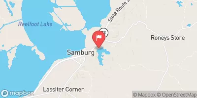
 Reelfoot Lake
 Reelfoot Lake Nr Tiptonville