Lk Palo Pinto Nr Santo Reservoir Report
Last Updated: February 12, 2026
LK Palo Pinto is a reservoir located in Santo, Texas, with a total capacity of 10,366 acre-feet.
Summary
The reservoir was built in 1939 by the Brazos River Authority to provide water to the surrounding area for irrigation and municipal purposes. The hydrology of the reservoir is supplied by the Palo Pinto Creek, which flows into the Brazos River. The reservoir is used for recreational activities such as fishing, boating, and camping. The reservoir also provides a source of water for agricultural purposes, including irrigation for crops such as cotton, wheat, and hay. The surrounding area receives an average annual snowpack of around 0.7 inches, which contributes to the surface flow of the reservoir. Overall, LK Palo Pinto plays an important role in providing water resources to the surrounding area for both agricultural and recreational purposes.
°F
°F
mph
Wind
%
Humidity
15-Day Weather Outlook
Reservoir Details
| Lake Or Reservoir Water Surface Elevation Above Ngvd 1929, Ft 24hr Change | 0.0% |
| Percent of Normal | 100% |
| Minimum |
846.65 ft
2015-02-22 |
| Maximum |
871.1 ft
2016-06-01 |
| Average | 863 ft |
Seasonal Comparison
Lake Or Reservoir Water Surface Elevation Above Ngvd 1929, Ft Levels
5-Day Hourly Forecast Detail
Nearby Streamflow Levels
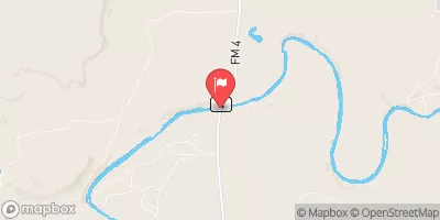 Brazos Rv Nr Palo Pinto
|
49cfs |
 Brazos Rv Nr Graford
|
57cfs |
 Brazos Rv Nr Dennis
|
56cfs |
 Brazos Rv Nr South Bend
|
36cfs |
 Leon Rv Nr De Leon
|
3cfs |
 Clear Fk Trinity Rv Nr Weatherford
|
0cfs |
Dam Data Reference
Condition Assessment
SatisfactoryNo existing or potential dam safety deficiencies are recognized. Acceptable performance is expected under all loading conditions (static, hydrologic, seismic) in accordance with the minimum applicable state or federal regulatory criteria or tolerable risk guidelines.
Fair
No existing dam safety deficiencies are recognized for normal operating conditions. Rare or extreme hydrologic and/or seismic events may result in a dam safety deficiency. Risk may be in the range to take further action. Note: Rare or extreme event is defined by the regulatory agency based on their minimum
Poor A dam safety deficiency is recognized for normal operating conditions which may realistically occur. Remedial action is necessary. POOR may also be used when uncertainties exist as to critical analysis parameters which identify a potential dam safety deficiency. Investigations and studies are necessary.
Unsatisfactory
A dam safety deficiency is recognized that requires immediate or emergency remedial action for problem resolution.
Not Rated
The dam has not been inspected, is not under state or federal jurisdiction, or has been inspected but, for whatever reason, has not been rated.
Not Available
Dams for which the condition assessment is restricted to approved government users.
Hazard Potential Classification
HighDams assigned the high hazard potential classification are those where failure or mis-operation will probably cause loss of human life.
Significant
Dams assigned the significant hazard potential classification are those dams where failure or mis-operation results in no probable loss of human life but can cause economic loss, environment damage, disruption of lifeline facilities, or impact other concerns. Significant hazard potential classification dams are often located in predominantly rural or agricultural areas but could be in areas with population and significant infrastructure.
Low
Dams assigned the low hazard potential classification are those where failure or mis-operation results in no probable loss of human life and low economic and/or environmental losses. Losses are principally limited to the owner's property.
Undetermined
Dams for which a downstream hazard potential has not been designated or is not provided.
Not Available
Dams for which the downstream hazard potential is restricted to approved government users.

 Lake Palo Pinto Dam
 Lk Palo Pinto Nr Santo