


Mitchell Reservoir Report
Last Updated: April 15, 2026
Nearby: Hardcastle Dam Mcgowen Gss 2
°F
°F
mph
Wind
%
Humidity
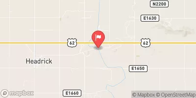
Mitchell is a privately owned earth dam located in Jackson, Oklahoma, along the TR-Red River.
Summary
Constructed in 1972 by the USDA NRCS, this dam stands at a height of 31 feet with a hydraulic height of 26 feet and a length of 500 feet. The primary purpose of Mitchell is categorized as 'Other', with a storage capacity of 61 acre-feet and a maximum discharge capacity. The dam is regulated by the Oklahoma Water Resources Board and undergoes regular inspections to ensure its structural integrity.
Despite being rated as having a low hazard potential, Mitchell is deemed to have a very high risk level, with a risk score of 1. The dam's condition is currently not rated, and there is no available data on its Emergency Action Plan (EAP) preparedness or the existence of inundation maps. However, Mitchell's risk management measures and emergency contacts have yet to be updated, reflecting a need for increased attention to safety protocols and preparedness. Water resource and climate enthusiasts will find Mitchell's data intriguing due to its unique structure, location, and risk profile, highlighting the importance of proper management and maintenance of dams to ensure public safety and environmental protection.
Regional Streamflow Levels


15-Day Long Term Forecast
Year Completed |
1972 |
Dam Length |
500 |
Dam Height |
31 |
River Or Stream |
TR-RED RIVER |
Primary Dam Type |
Earth |
Hydraulic Height |
26 |
Nid Storage |
61 |
Structural Height |
31 |
Hazard Potential |
Low |
Nid Height |
31 |
Seasonal Comparison
5-Day Hourly Forecast Detail
Dam Data Reference
Condition Assessment
SatisfactoryNo existing or potential dam safety deficiencies are recognized. Acceptable performance is expected under all loading conditions (static, hydrologic, seismic) in accordance with the minimum applicable state or federal regulatory criteria or tolerable risk guidelines.
Fair
No existing dam safety deficiencies are recognized for normal operating conditions. Rare or extreme hydrologic and/or seismic events may result in a dam safety deficiency. Risk may be in the range to take further action. Note: Rare or extreme event is defined by the regulatory agency based on their minimum
Poor A dam safety deficiency is recognized for normal operating conditions which may realistically occur. Remedial action is necessary. POOR may also be used when uncertainties exist as to critical analysis parameters which identify a potential dam safety deficiency. Investigations and studies are necessary.
Unsatisfactory
A dam safety deficiency is recognized that requires immediate or emergency remedial action for problem resolution.
Not Rated
The dam has not been inspected, is not under state or federal jurisdiction, or has been inspected but, for whatever reason, has not been rated.
Not Available
Dams for which the condition assessment is restricted to approved government users.
Hazard Potential Classification
HighDams assigned the high hazard potential classification are those where failure or mis-operation will probably cause loss of human life.
Significant
Dams assigned the significant hazard potential classification are those dams where failure or mis-operation results in no probable loss of human life but can cause economic loss, environment damage, disruption of lifeline facilities, or impact other concerns. Significant hazard potential classification dams are often located in predominantly rural or agricultural areas but could be in areas with population and significant infrastructure.
Low
Dams assigned the low hazard potential classification are those where failure or mis-operation results in no probable loss of human life and low economic and/or environmental losses. Losses are principally limited to the owner's property.
Undetermined
Dams for which a downstream hazard potential has not been designated or is not provided.
Not Available
Dams for which the downstream hazard potential is restricted to approved government users.