
Summary
Built in 1945, this earth dam stands at a height of 13 feet and has a length of 26,400 feet, providing a maximum storage capacity of 2,870 acre-feet. The primary purpose of this levee is listed as "Other," indicating its multifunctional role in water management.
Despite its age, the Dupont Plant Reservoir Levee is regulated and inspected by the Texas Commission on Environmental Quality (TCEQ) to ensure its structural integrity and compliance with state regulations. The risk assessment for this structure is moderate, highlighting the importance of ongoing monitoring and maintenance to prevent any potential hazards. With an uncontrolled spillway and two outlet gates, the Dupont Plant Reservoir Levee plays a crucial role in managing water flow and protecting the surrounding area from flooding.
Enthusiasts of water resources and climate will be interested in the Dupont Plant Reservoir Levee for its historical significance, functional design, and ongoing regulatory oversight. This structure exemplifies the importance of maintaining and monitoring levees to ensure the safety and security of communities in flood-prone areas like Orange, Texas. Its location along Adams Bayou and the Sabine River underscores its strategic importance in managing water resources in the region, making it a noteworthy feature for those interested in the intersection of water management and climate resilience.
Year Completed |
1945 |
Dam Length |
26400 |
Dam Height |
13 |
River Or Stream |
ADAMS BAYOU - SABINE RIVER |
Primary Dam Type |
Earth |
Hydraulic Height |
13 |
Nid Storage |
2870 |
Structural Height |
13 |
Outlet Gates |
Uncontrolled - 2 |
Hazard Potential |
Not Available |
Foundations |
Unlisted/Unknown |
Nid Height |
13 |
Seasonal Comparison
Weather Forecast
Nearby Streamflow Levels
 Cow Bayou Nr Mauriceville
|
0cfs |
 Sabine Rv Nr Ruliff
|
955cfs |
 Neches Rv Saltwater Barrier At Beaumont
|
509cfs |
 Pine Island Bayou Abv Bi Pump Plant
|
52cfs |
 Neches Rv At Evadale
|
1200cfs |
 Pine Island Bayou Nr Sour Lake
|
3cfs |
Dam Data Reference
Condition Assessment
SatisfactoryNo existing or potential dam safety deficiencies are recognized. Acceptable performance is expected under all loading conditions (static, hydrologic, seismic) in accordance with the minimum applicable state or federal regulatory criteria or tolerable risk guidelines.
Fair
No existing dam safety deficiencies are recognized for normal operating conditions. Rare or extreme hydrologic and/or seismic events may result in a dam safety deficiency. Risk may be in the range to take further action. Note: Rare or extreme event is defined by the regulatory agency based on their minimum
Poor A dam safety deficiency is recognized for normal operating conditions which may realistically occur. Remedial action is necessary. POOR may also be used when uncertainties exist as to critical analysis parameters which identify a potential dam safety deficiency. Investigations and studies are necessary.
Unsatisfactory
A dam safety deficiency is recognized that requires immediate or emergency remedial action for problem resolution.
Not Rated
The dam has not been inspected, is not under state or federal jurisdiction, or has been inspected but, for whatever reason, has not been rated.
Not Available
Dams for which the condition assessment is restricted to approved government users.
Hazard Potential Classification
HighDams assigned the high hazard potential classification are those where failure or mis-operation will probably cause loss of human life.
Significant
Dams assigned the significant hazard potential classification are those dams where failure or mis-operation results in no probable loss of human life but can cause economic loss, environment damage, disruption of lifeline facilities, or impact other concerns. Significant hazard potential classification dams are often located in predominantly rural or agricultural areas but could be in areas with population and significant infrastructure.
Low
Dams assigned the low hazard potential classification are those where failure or mis-operation results in no probable loss of human life and low economic and/or environmental losses. Losses are principally limited to the owner's property.
Undetermined
Dams for which a downstream hazard potential has not been designated or is not provided.
Not Available
Dams for which the downstream hazard potential is restricted to approved government users.
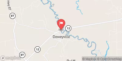
 Dupont Plant Reservoir Levee
 South Carpenter Road 6599, Orange