Mt. Pleasant - Pleasant Creek (Lower) Reservoir Report
Last Updated: February 11, 2026
Located in Mt.
Summary
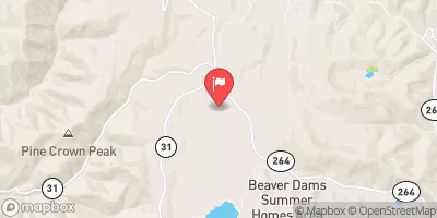
Pleasant, Utah, the Pleasant Creek (Lower) dam is a vital structure managed by the local government for flood risk reduction. Designed by the USDA NRCS, this earth dam stands at a structural height of 20 feet and spans a length of 2200 feet. The dam is regulated by the Utah Division of Water Rights and undergoes regular inspections to ensure its effectiveness in protecting the surrounding area from potential flooding.
With a significant hazard potential, the Pleasant Creek (Lower) dam plays a crucial role in safeguarding the local community from flood events. Although the condition assessment is currently not rated, the dam is inspected every three years to maintain its structural integrity and effectiveness. The dam's location in a high-risk area underscores the importance of its role in mitigating flood risks and protecting the surrounding environment and population.
As water resource and climate enthusiasts, understanding the intricacies of the Pleasant Creek (Lower) dam provides insight into the complex network of infrastructure necessary for managing water resources and mitigating natural hazards. With its primary purpose of flood risk reduction, this dam serves as a critical asset in the community's resilience against potential disasters, highlighting the importance of proactive maintenance and regulatory oversight in safeguarding water resources and infrastructure.
°F
°F
mph
Wind
%
Humidity
15-Day Weather Outlook
Dam Length |
2200 |
River Or Stream |
PLEASANT CREEK |
Primary Dam Type |
Earth |
Drainage Area |
19.2 |
Structural Height |
20 |
Hazard Potential |
Significant |
Nid Height |
20 |
Seasonal Comparison
5-Day Hourly Forecast Detail
Nearby Streamflow Levels
Dam Data Reference
Condition Assessment
SatisfactoryNo existing or potential dam safety deficiencies are recognized. Acceptable performance is expected under all loading conditions (static, hydrologic, seismic) in accordance with the minimum applicable state or federal regulatory criteria or tolerable risk guidelines.
Fair
No existing dam safety deficiencies are recognized for normal operating conditions. Rare or extreme hydrologic and/or seismic events may result in a dam safety deficiency. Risk may be in the range to take further action. Note: Rare or extreme event is defined by the regulatory agency based on their minimum
Poor A dam safety deficiency is recognized for normal operating conditions which may realistically occur. Remedial action is necessary. POOR may also be used when uncertainties exist as to critical analysis parameters which identify a potential dam safety deficiency. Investigations and studies are necessary.
Unsatisfactory
A dam safety deficiency is recognized that requires immediate or emergency remedial action for problem resolution.
Not Rated
The dam has not been inspected, is not under state or federal jurisdiction, or has been inspected but, for whatever reason, has not been rated.
Not Available
Dams for which the condition assessment is restricted to approved government users.
Hazard Potential Classification
HighDams assigned the high hazard potential classification are those where failure or mis-operation will probably cause loss of human life.
Significant
Dams assigned the significant hazard potential classification are those dams where failure or mis-operation results in no probable loss of human life but can cause economic loss, environment damage, disruption of lifeline facilities, or impact other concerns. Significant hazard potential classification dams are often located in predominantly rural or agricultural areas but could be in areas with population and significant infrastructure.
Low
Dams assigned the low hazard potential classification are those where failure or mis-operation results in no probable loss of human life and low economic and/or environmental losses. Losses are principally limited to the owner's property.
Undetermined
Dams for which a downstream hazard potential has not been designated or is not provided.
Not Available
Dams for which the downstream hazard potential is restricted to approved government users.
Area Campgrounds
| Location | Reservations | Toilets |
|---|---|---|
 Spring City
|
||
 Lake Canyon Rec Area Campground
|
||
 Lake Canyon Rec Area
|
||
 Lake Canyon Campground
|
||
 Cleveland Reservoir Campground
|
||
 Potters Pond Campground
|


 Mt. Pleasant - Pleasant Creek (Lower)
 Huntington Reservoir
 Rolfson Reservoir
 Fairview Lakes
 Huntington Reservoir/Mammoth Fishing Site
 Miller Flat Reservoir