Cedar City - Fiddler Canyon Db #2 Reservoir Report
Last Updated: February 21, 2026
Cedar City - Fiddler Canyon Db #2 is a private dam located in Iron County, Utah, designed for flood risk reduction.
Summary
Completed in 2000, this earth dam stands at a hydraulic height of 43 feet and a structural height of 46 feet, with a length of 630 feet. With a maximum storage capacity of 94 acre-feet and a normal storage capacity of 80 acre-feet, the dam serves a vital role in managing water flow in the region.
Managed by the Utah Division of Water Rights, Cedar City - Fiddler Canyon Db #2 has a high hazard potential but is rated as being in satisfactory condition. The dam undergoes regular inspections, with the last assessment conducted in September 2019. The dam's emergency action plan status and risk assessment measures are not specified in the data, but its effective flood risk reduction purpose underscores its importance for water resource and climate management enthusiasts in the region.
Situated within the Los Angeles District, Cedar City - Fiddler Canyon Db #2 plays a crucial role in mitigating flood risks and safeguarding the surrounding area from potential inundation. With its strategic location and functional design, this dam stands as a testament to effective water resource management practices in Utah. For those interested in water infrastructure and climate resilience, this site offers valuable insights into the intersection of engineering, environment, and public safety.
°F
°F
mph
Wind
%
Humidity
15-Day Weather Outlook
Year Completed |
2000 |
Dam Length |
630 |
Primary Dam Type |
Earth |
Hydraulic Height |
43 |
Drainage Area |
7.57 |
Nid Storage |
94 |
Structural Height |
46 |
Hazard Potential |
High |
Foundations |
Rock |
Nid Height |
46 |
Seasonal Comparison
5-Day Hourly Forecast Detail
Nearby Streamflow Levels
Dam Data Reference
Condition Assessment
SatisfactoryNo existing or potential dam safety deficiencies are recognized. Acceptable performance is expected under all loading conditions (static, hydrologic, seismic) in accordance with the minimum applicable state or federal regulatory criteria or tolerable risk guidelines.
Fair
No existing dam safety deficiencies are recognized for normal operating conditions. Rare or extreme hydrologic and/or seismic events may result in a dam safety deficiency. Risk may be in the range to take further action. Note: Rare or extreme event is defined by the regulatory agency based on their minimum
Poor A dam safety deficiency is recognized for normal operating conditions which may realistically occur. Remedial action is necessary. POOR may also be used when uncertainties exist as to critical analysis parameters which identify a potential dam safety deficiency. Investigations and studies are necessary.
Unsatisfactory
A dam safety deficiency is recognized that requires immediate or emergency remedial action for problem resolution.
Not Rated
The dam has not been inspected, is not under state or federal jurisdiction, or has been inspected but, for whatever reason, has not been rated.
Not Available
Dams for which the condition assessment is restricted to approved government users.
Hazard Potential Classification
HighDams assigned the high hazard potential classification are those where failure or mis-operation will probably cause loss of human life.
Significant
Dams assigned the significant hazard potential classification are those dams where failure or mis-operation results in no probable loss of human life but can cause economic loss, environment damage, disruption of lifeline facilities, or impact other concerns. Significant hazard potential classification dams are often located in predominantly rural or agricultural areas but could be in areas with population and significant infrastructure.
Low
Dams assigned the low hazard potential classification are those where failure or mis-operation results in no probable loss of human life and low economic and/or environmental losses. Losses are principally limited to the owner's property.
Undetermined
Dams for which a downstream hazard potential has not been designated or is not provided.
Not Available
Dams for which the downstream hazard potential is restricted to approved government users.
Area Campgrounds
| Location | Reservations | Toilets |
|---|---|---|
 Cedar Canyon Campground
|
||
 Cedar Canyon
|
||
 Deer Haven Campground
|

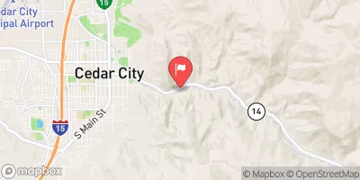
 Cedar City - Fiddler Canyon Db #2